Project Highlights
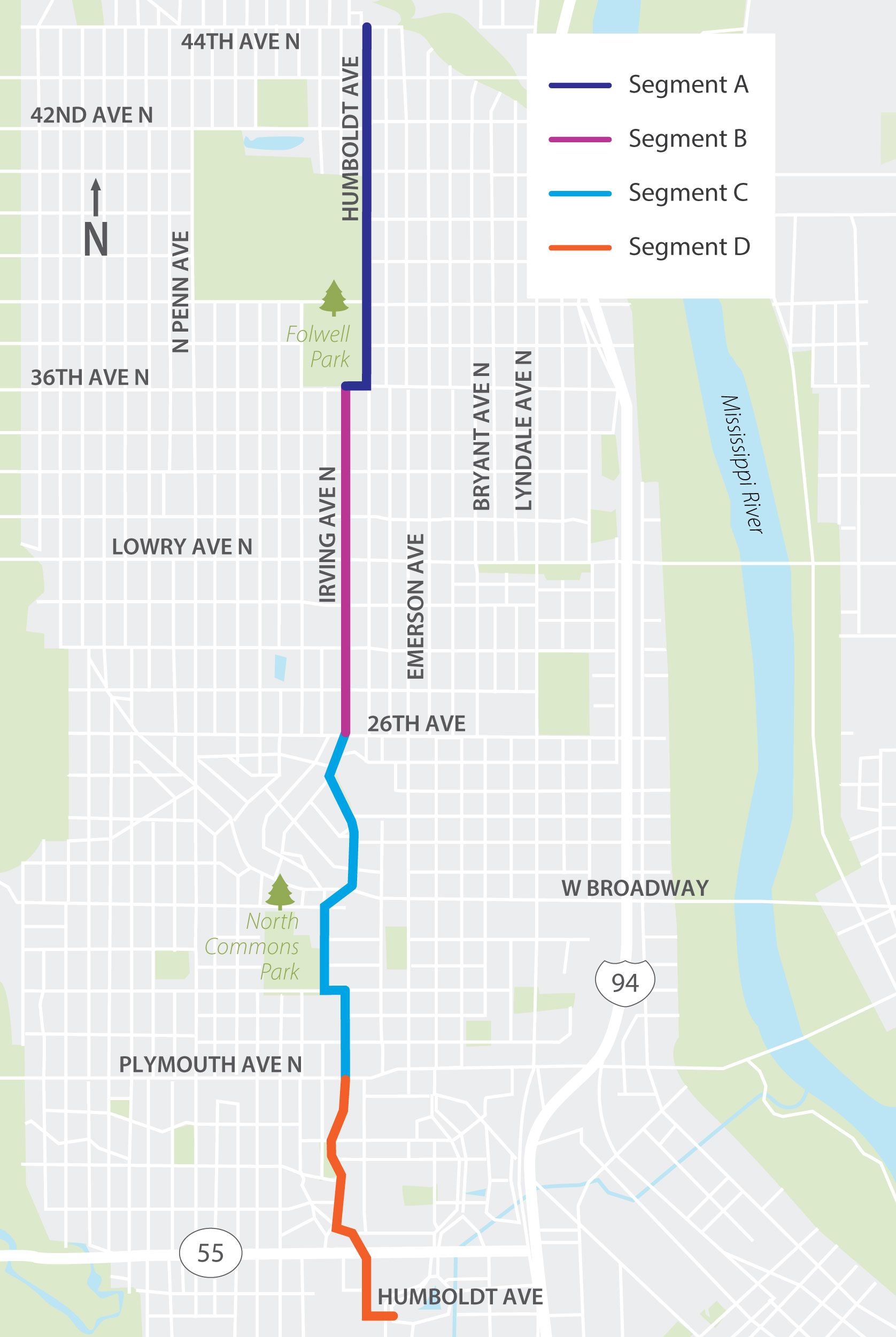
The Northside Greenway is an almost 4-mile route on Irving Ave N and Humboldt Ave N from 44th Ave N to Van White Memorial Blvd in north Minneapolis. The project will include traffic calming and safety improvements, new green spaces, and other community amenities. In 2025, the project team shared early design ideas and sought community feedback. We anticipate construction will begin in 2027.
- Northside Greenway is a proposed four-mile neighborhood greenway along Humboldt Ave N and Irving Ave N in North Minneapolis.
- Started initially as a community-generated idea with City and community organization engagement happening since 2011 with demonstration projects, surveys, and other activities.
- Identified as a low-stress bikeway on the City’s All Ages & Abilities (AAA) network.
- The Northside Greenway will connect or be near to several public schools, parks and trails, and transit lines.
Project Improvements
The section that follows includes the proposed improvements for the project route. Using the map and key, view the recommended design for your block in the tabs below.
Upcoming Events
Stay tuned for upcoming events.
Goals and Objectives
Create safe and comfortable places for everyone to travel, regardless of their age or ability.
- Traffic calming: Design the street to promote safe vehicle travel speeds.
- Crashes: Include features to reduce the likelihood of severe crashes.
- Access: Ensure that people can get to the places they need to go, regardless of how they travel.
Provide a safe and connected experience for people walking, rolling and biking.
- Safe routes: Create safe and comfortable places for people to walk, roll, and bike in support of the city’s Transportation Action Plan.
- Safe crossings: Make it safe and easy for people to cross the street, particularly at major intersections like Dowling Avenue, Lowry Avenue, Broadway Avenue, Plymouth Avenue, and Olson Memorial Highway.
- Connections: Create seamless connections to the places people want to go, such as area parks, schools, and businesses.
- Human-scale elements: Include features to support walking and biking, such as places to sit, trash cans, pedestrian level lighting, and places to gather.
Support and foster community identity.
- Green space: Provide space for more green space and plantings throughout the corridor (e.g., street trees, boulevard plantings, and gardens).
- Placemaking: Explore possibilities for features such as public art, wayfinding, and places to gather or play in support of creating vibrant community hubs where all are welcome.
- Sustainability: Create opportunities to improve water quality with green stormwater infrastructure where feasible (i.e., rain gardens, tree trenches, sustainable plantings, etc.) and promote environmental resiliency in accordance with the city’s Climate Equity Plan.
- Local residents: Support local residents by seeking to minimize impacts to private property, and exploring strategies to minimize the potential for displacement and gentrification in accordance with the city’s Racial Equity Framework.
- Local businesses: Celebrate local businesses through intentional connections to the Northside Greenway.
Community Input Summary
The project team engaged community members from Summer of 2024 through Summer 2025, introducing the project, understanding how community members use the corridor, and collecting input on priorities for improvements.
What we did
- Eighteen pop-ups
- Four neighborhood association meetings/listening sessions
- One public open house
- One Northside Greenway Community Fun Day
- Three meetings with local schools
- Door knocking – 580 homes
- Interactive mapping activity – 238 interactions
What we heard
More traffic calming
Traffic diverters, traffic circles, raised crossings, stop signs, pedestrian medians, and curb extensions were popular traffic calming features shared by community members at engagement events.
Better Places to walk and bike
Wider sidewalks, modern curb ramps at corners, safer places to cross the street, and pedestrian lighting were desired improvements for pedestrians. Bicyclists desired separated trails, safer places to cross the street, and wayfinding signage throughout the project corridor.
More arts and culture, community amenities, and greenspace
Public art and other cultural amenities to highlight the identity of the community were a priority among community members along with new community amenities, like seating areas, play spots, more space for plantings and trees, and garbage cans.
Traffic flow improvements
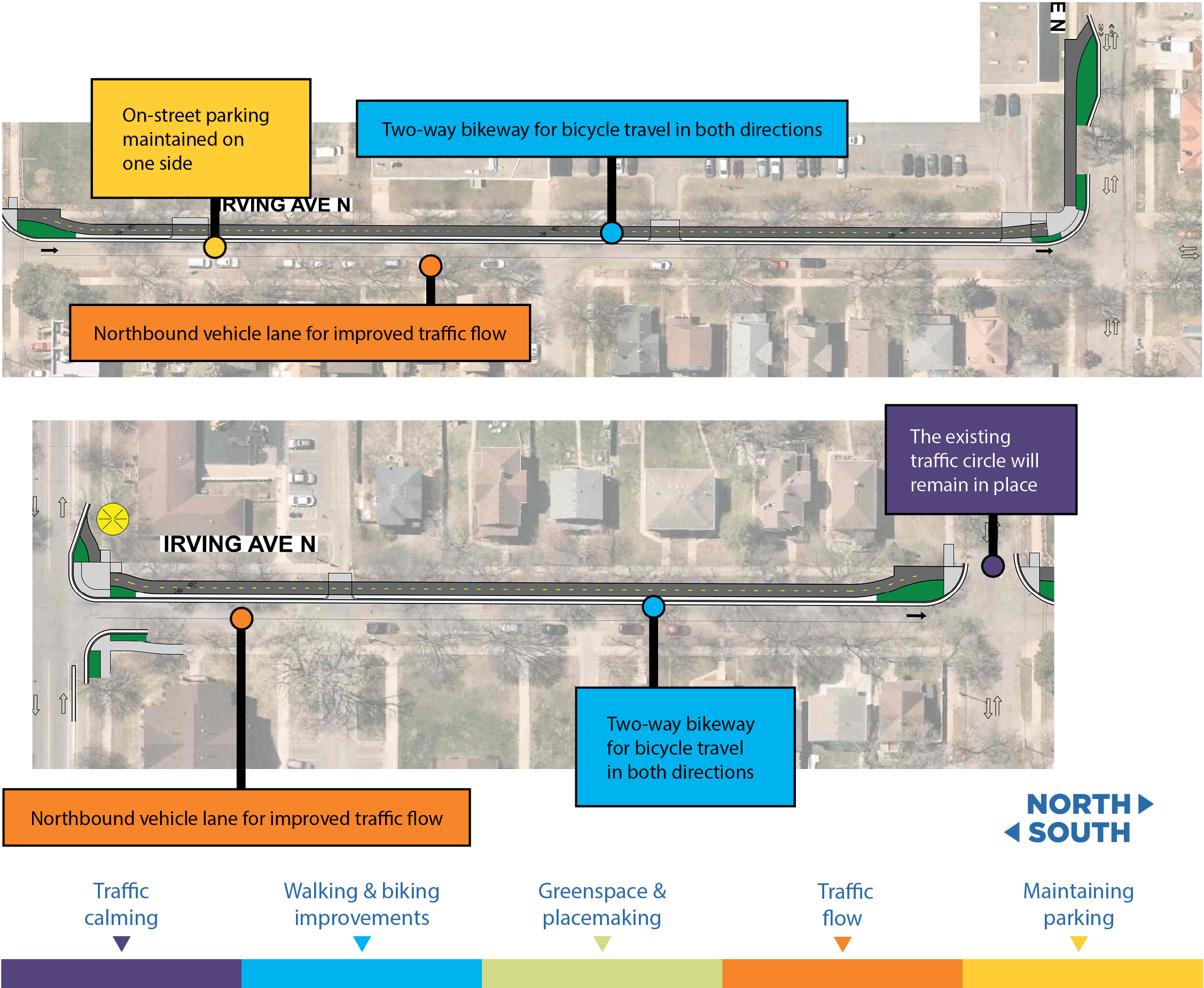
People noted that making Irving Avenue a one-way street would make things safer, though, some shared concerns about reduced on-street parking and the potential for cars driving the wrong way.
Maintaining on-street parking
Retaining as much on-street parking as possible is a priority for people who participated in engagement events.
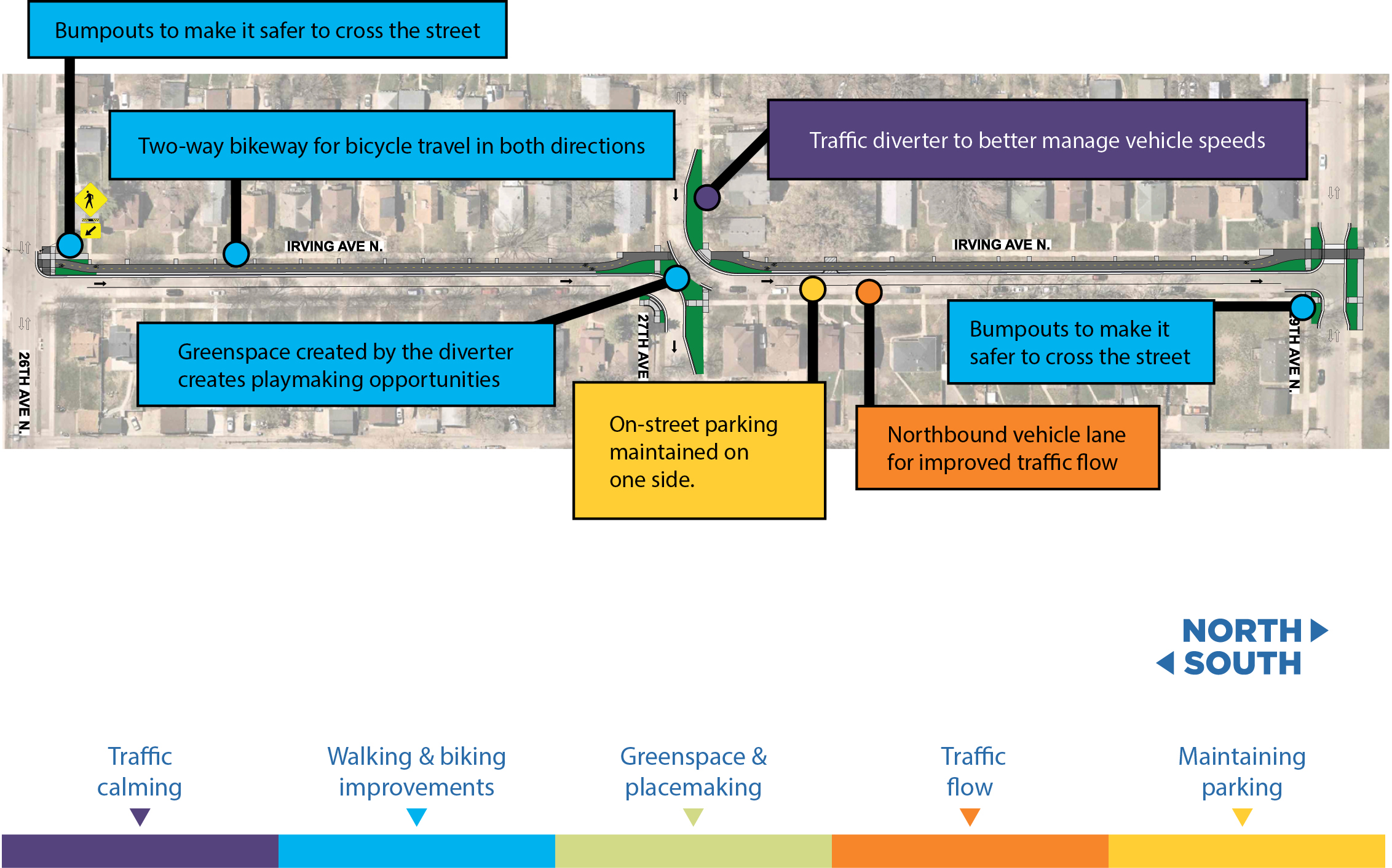
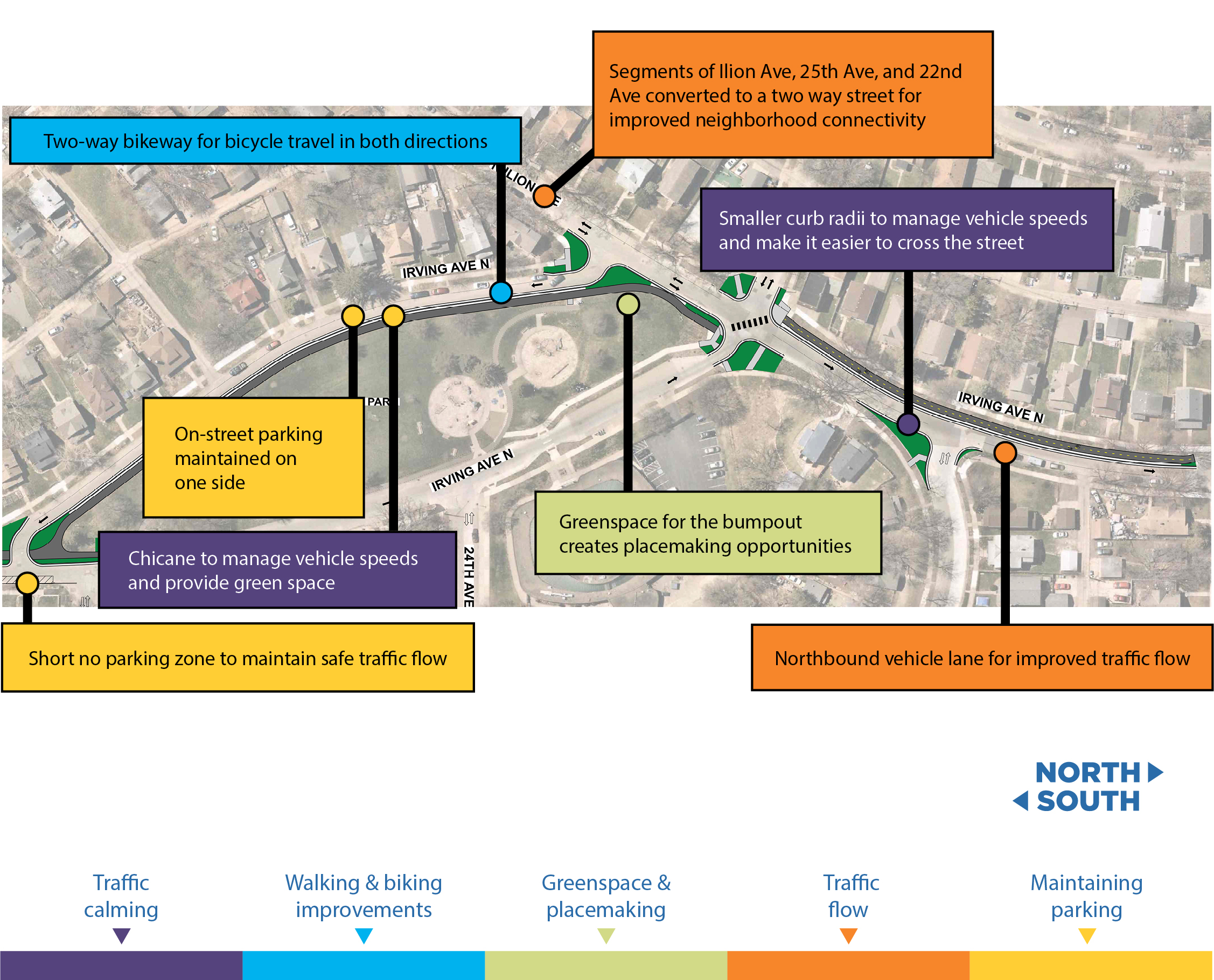
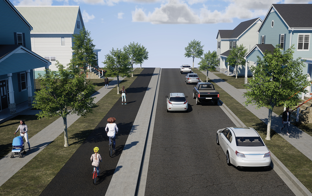
Design recommendations
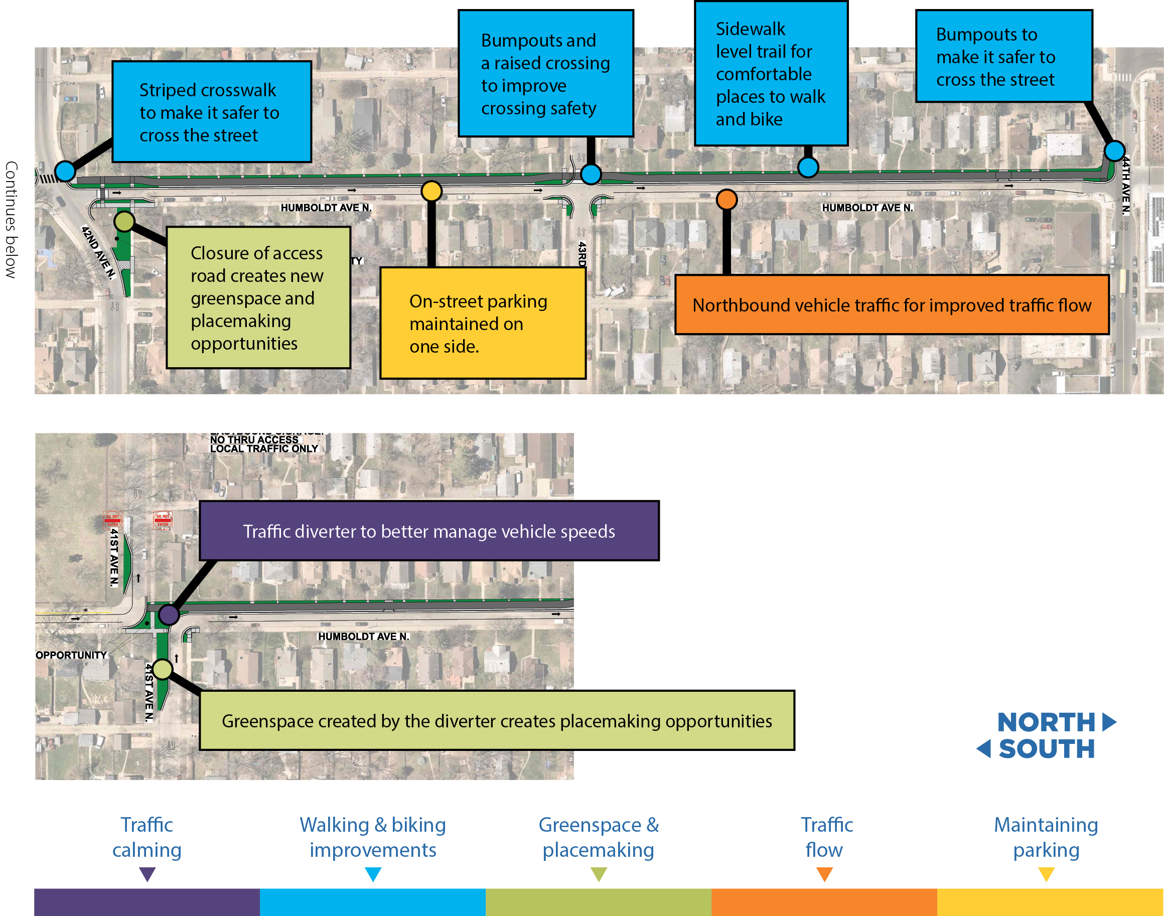
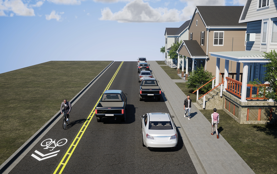
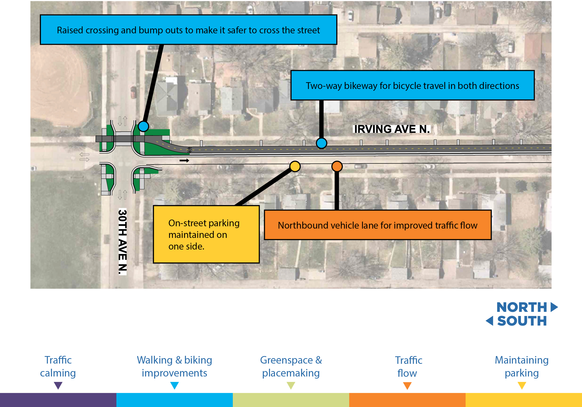
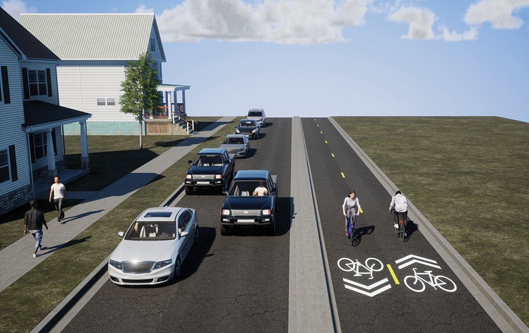
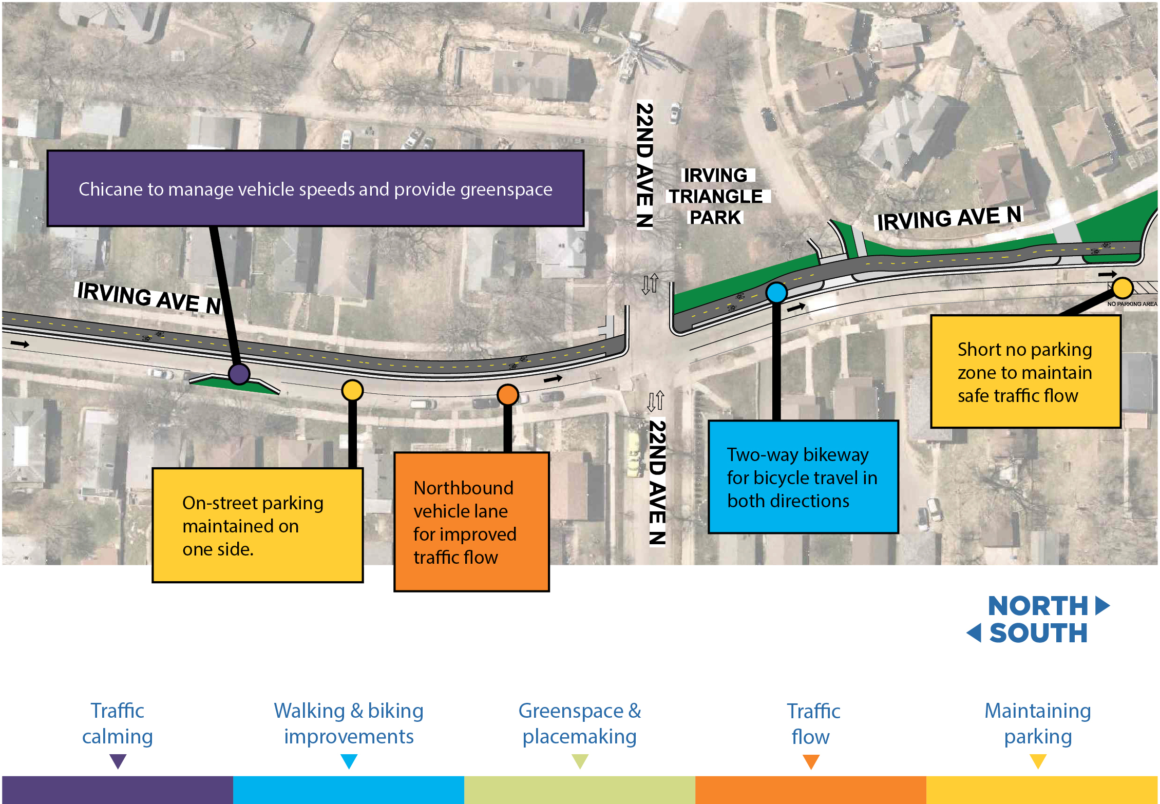
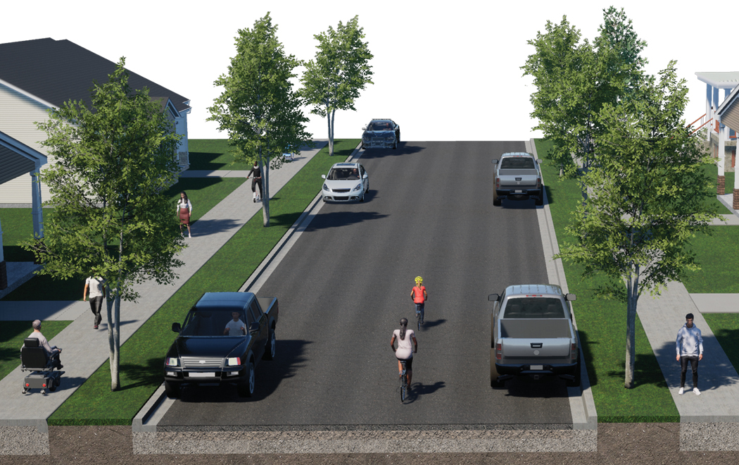
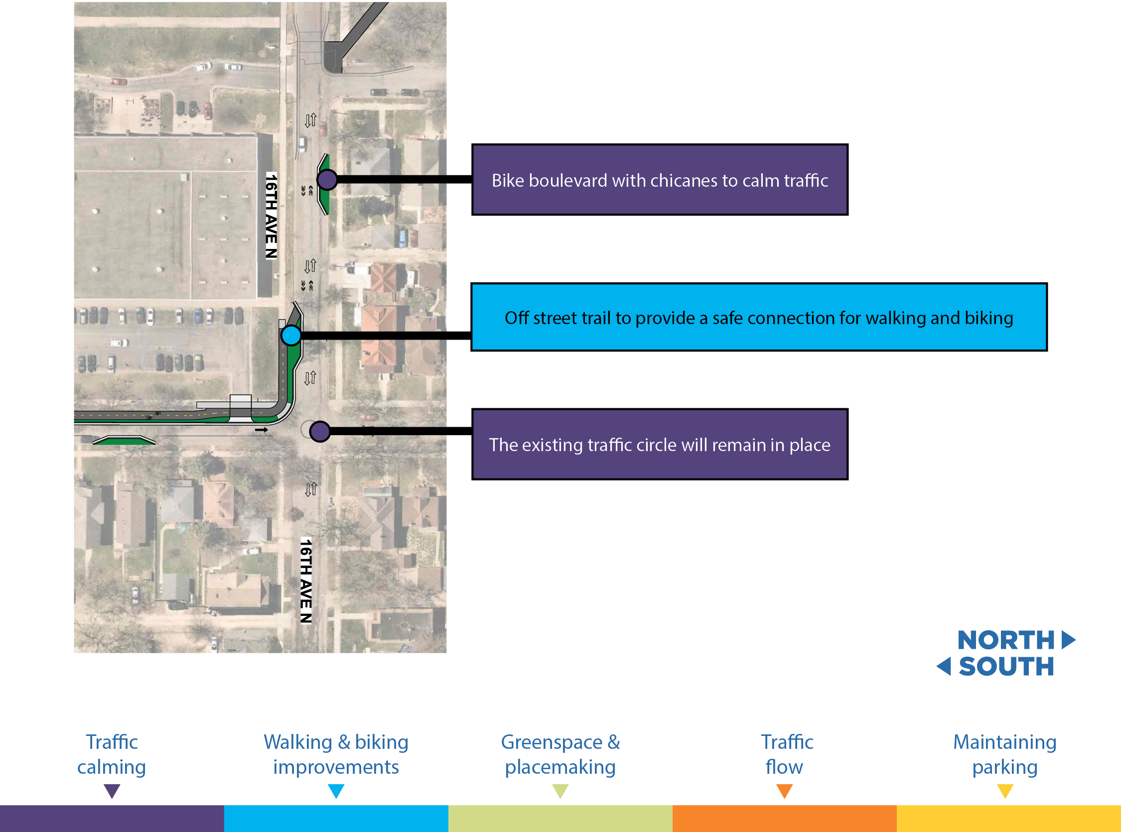
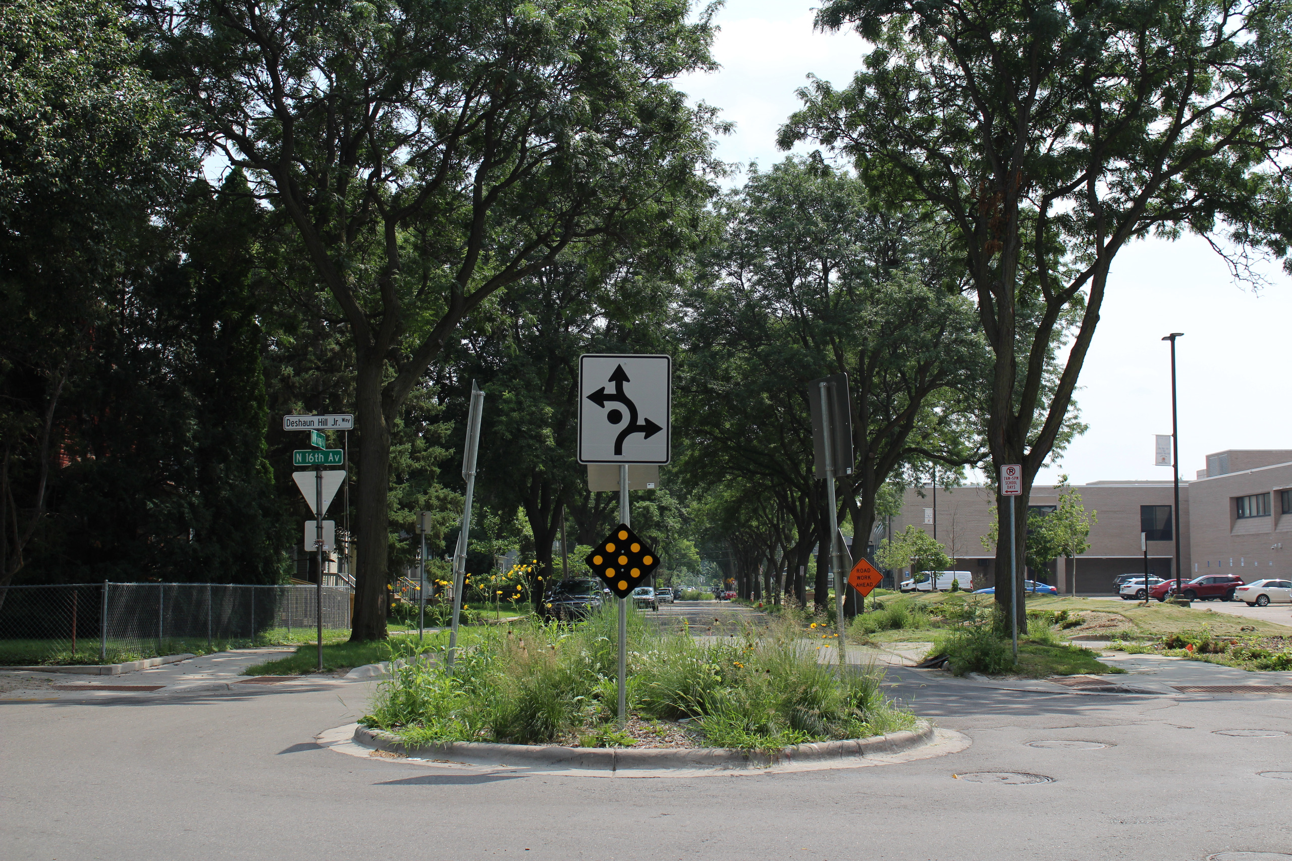
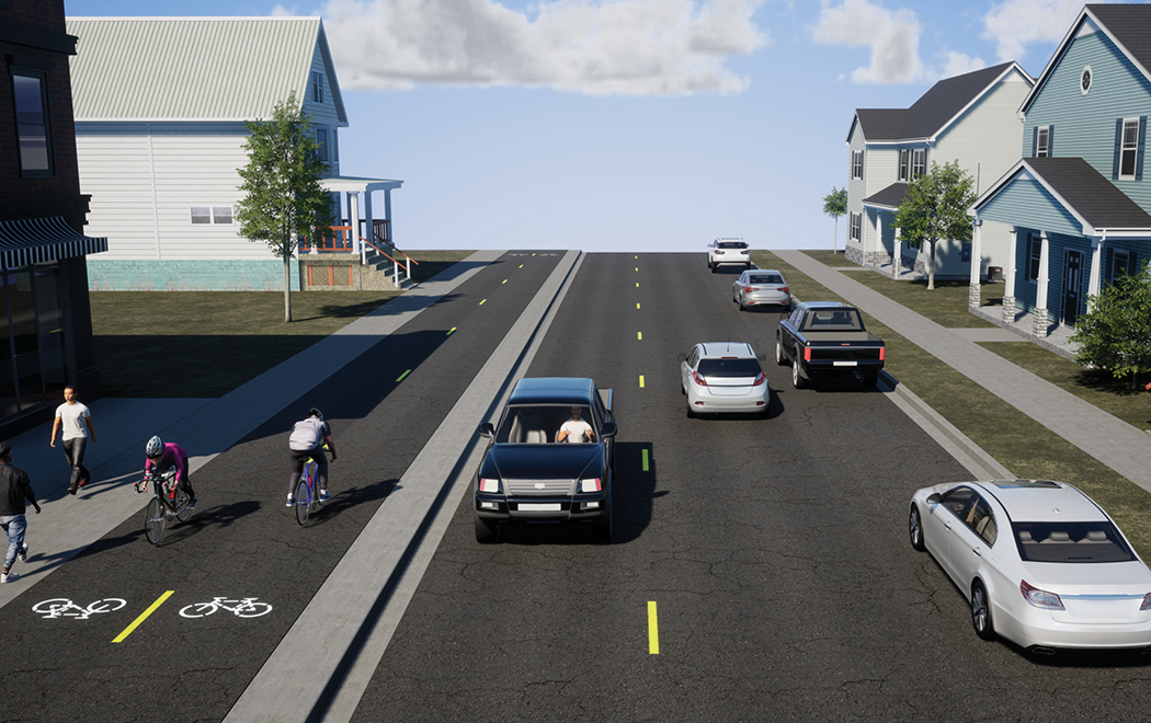
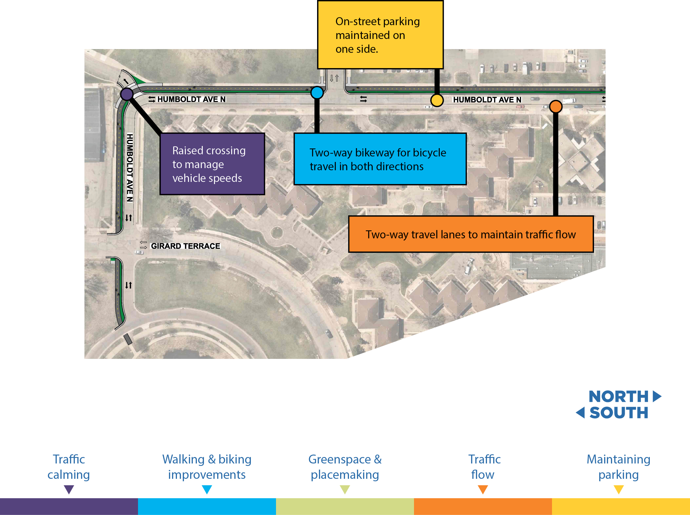
Traffic calming
Chicanes, traffic diverters and other features to encourage safe vehicle speeds.
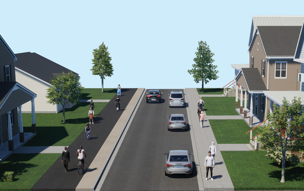
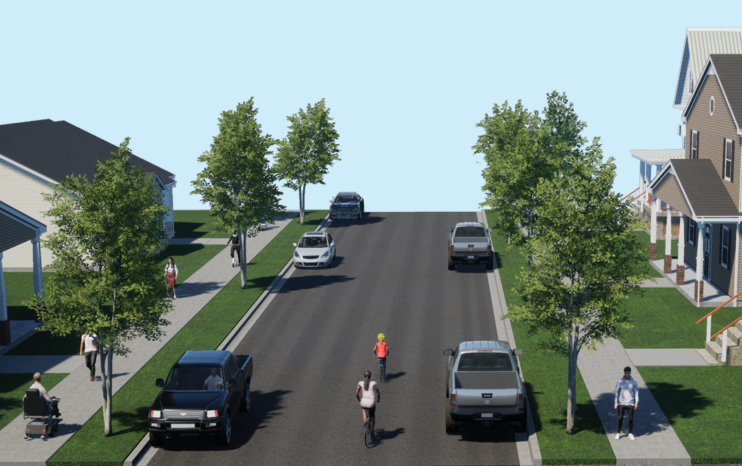
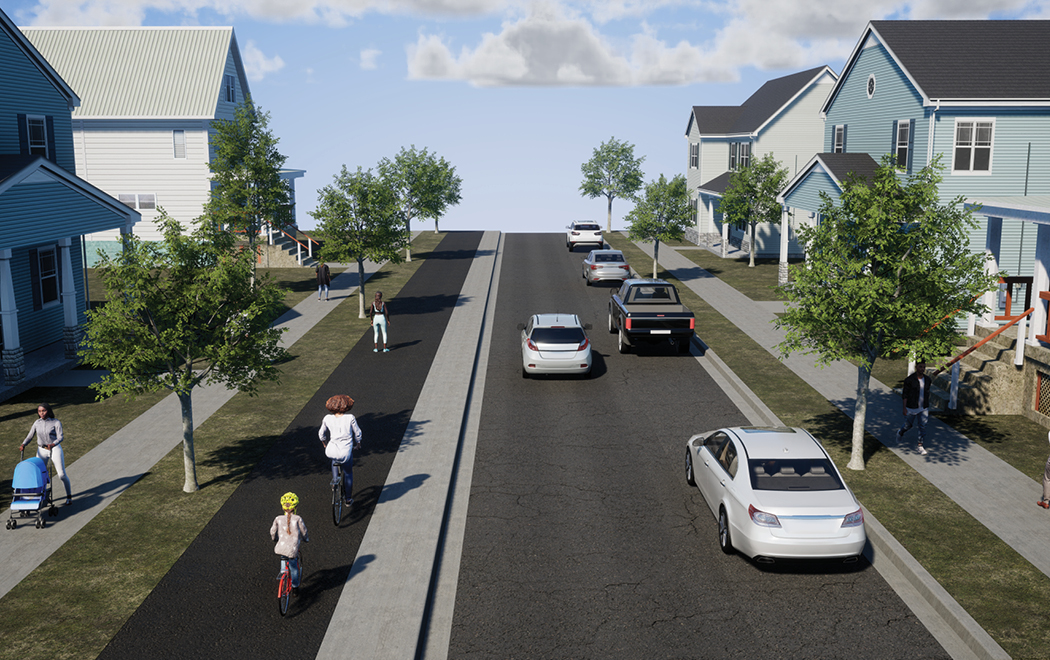
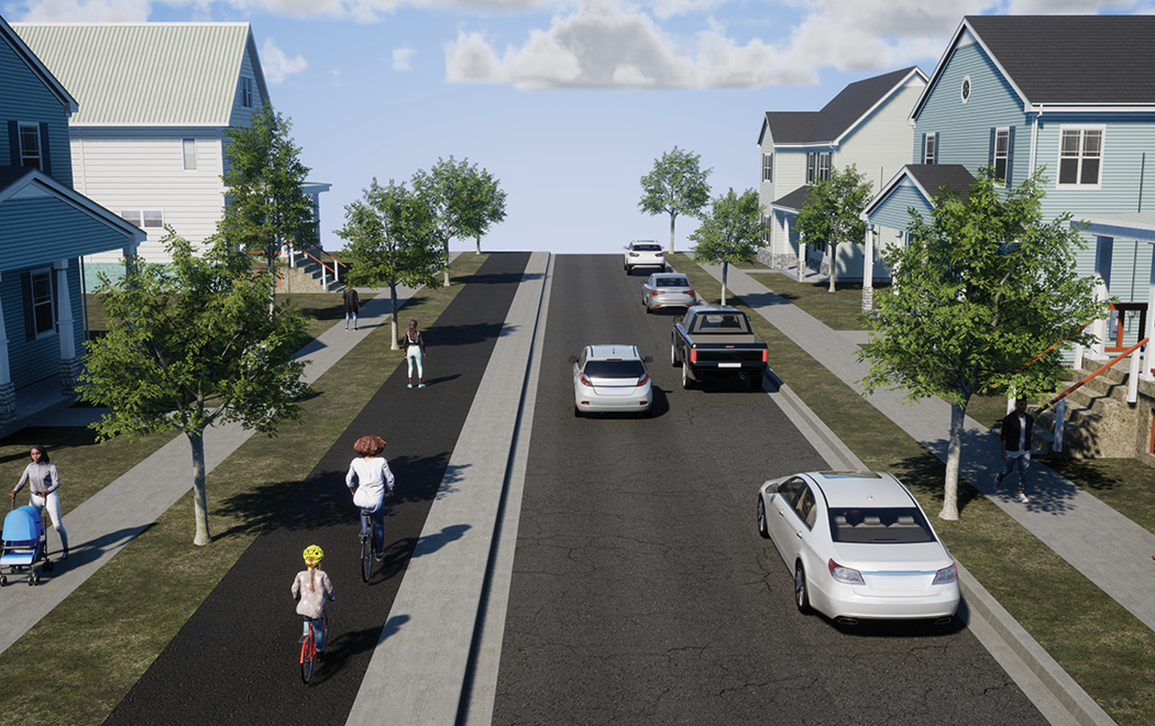
Walking & biking improvements
Raised crosswalks, bumpouts, pedestrian crossing medians, and sidewalk level trails to make it safe and comfortable to walk and bike.
Greenspace & placemaking
New space created by traffic calming, walking, and biking improvements provides an opportunity for features such as new plantings, street trees, and public art.
Traffic flow
One way street conversions will create space for greenway improvements while maintaining traffic flow and property access.
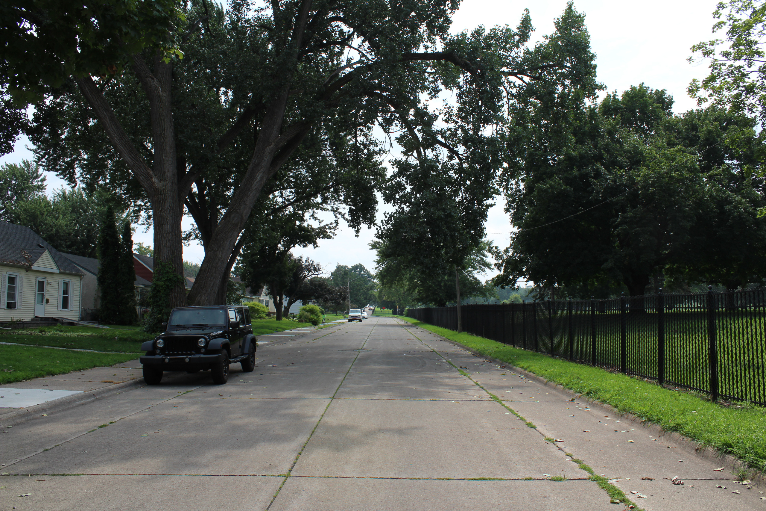
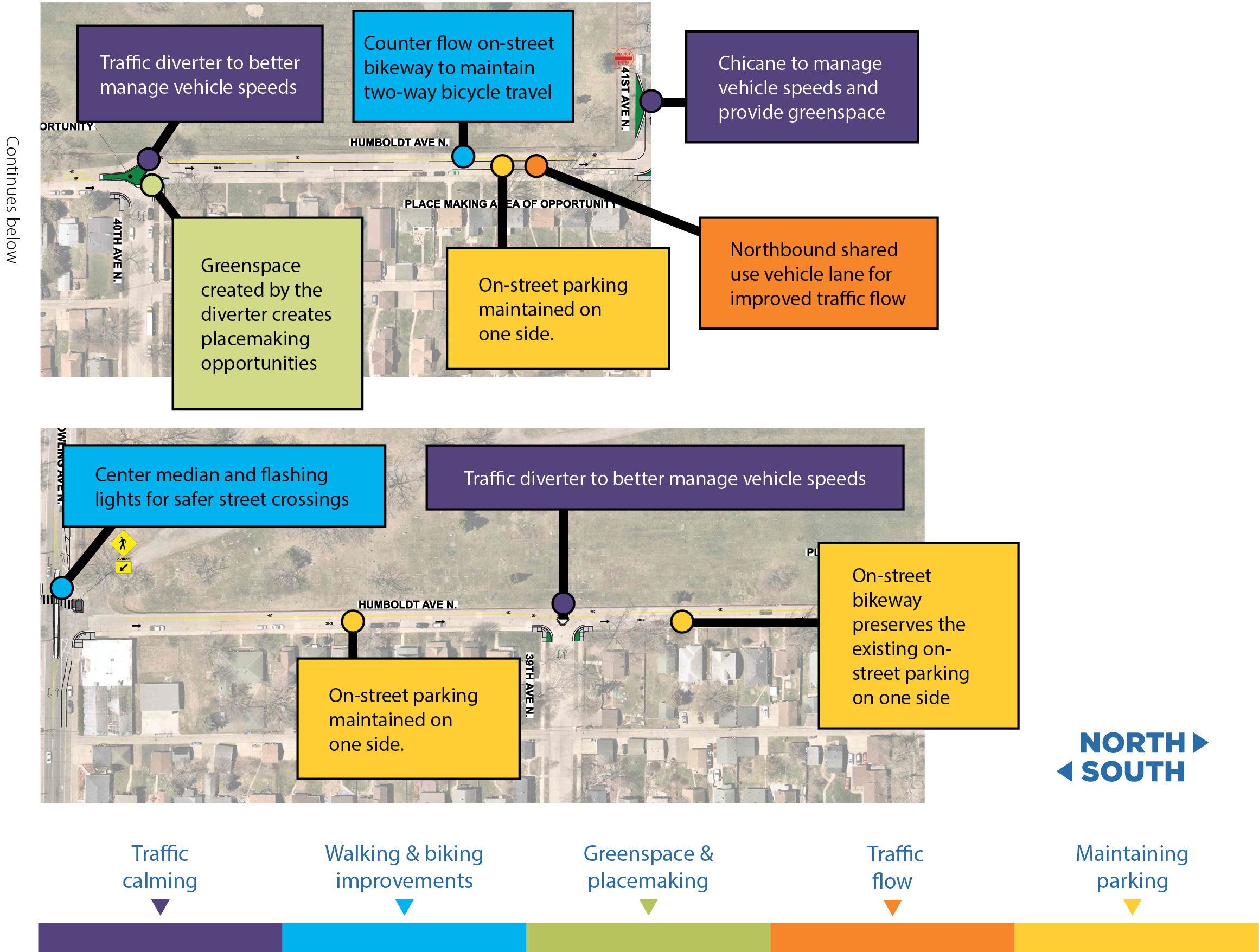
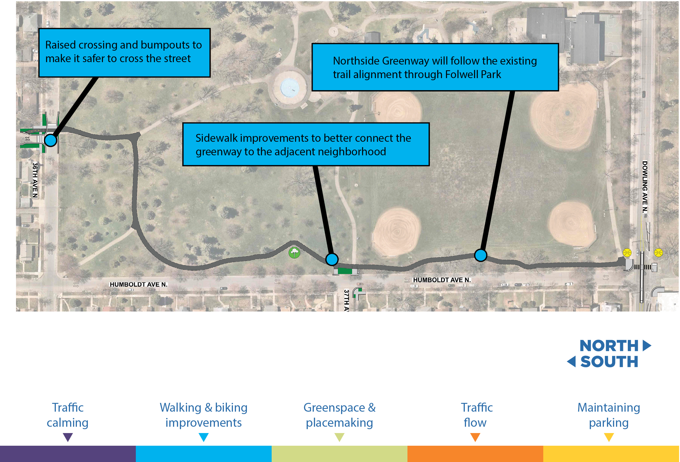
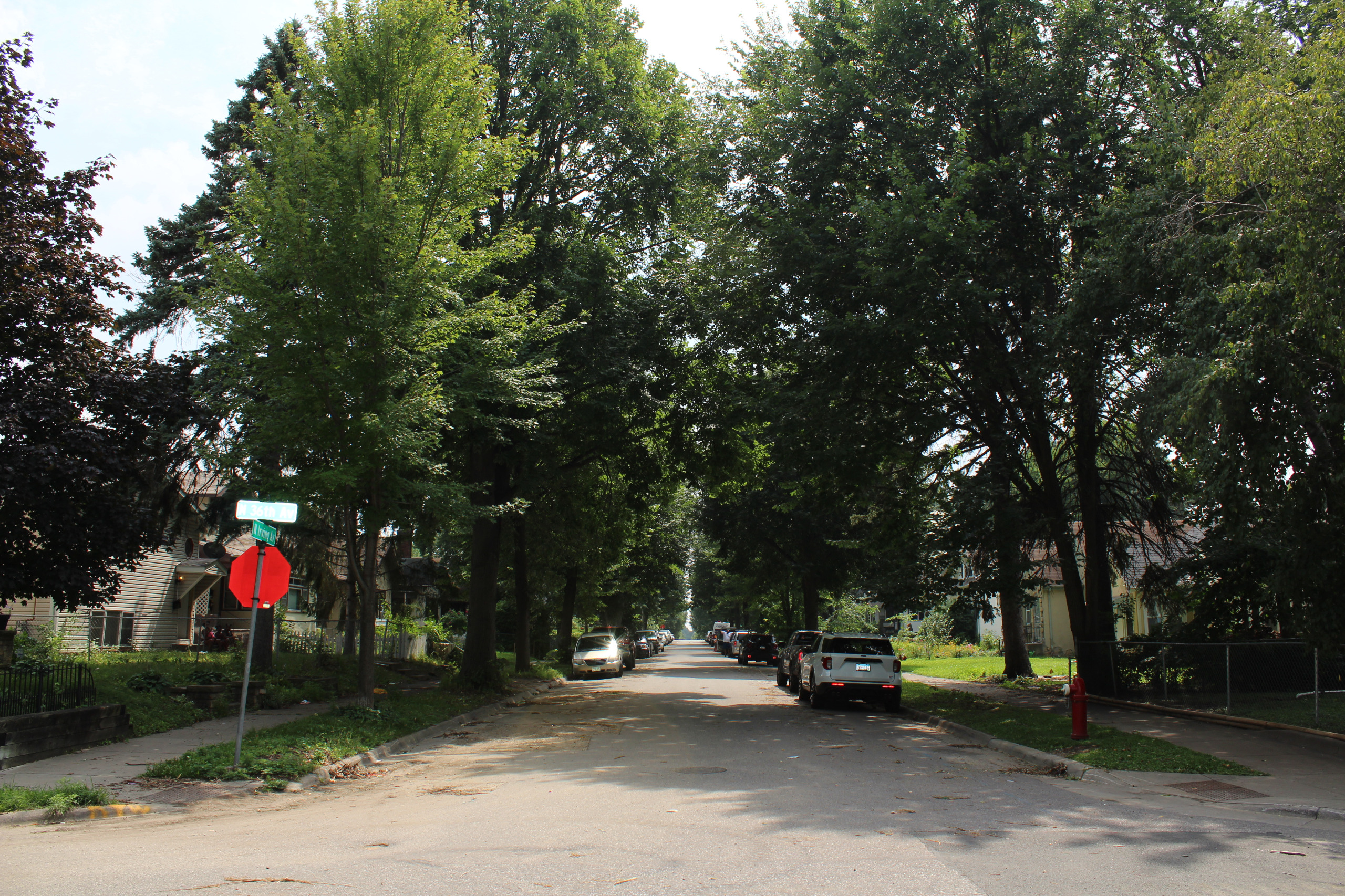
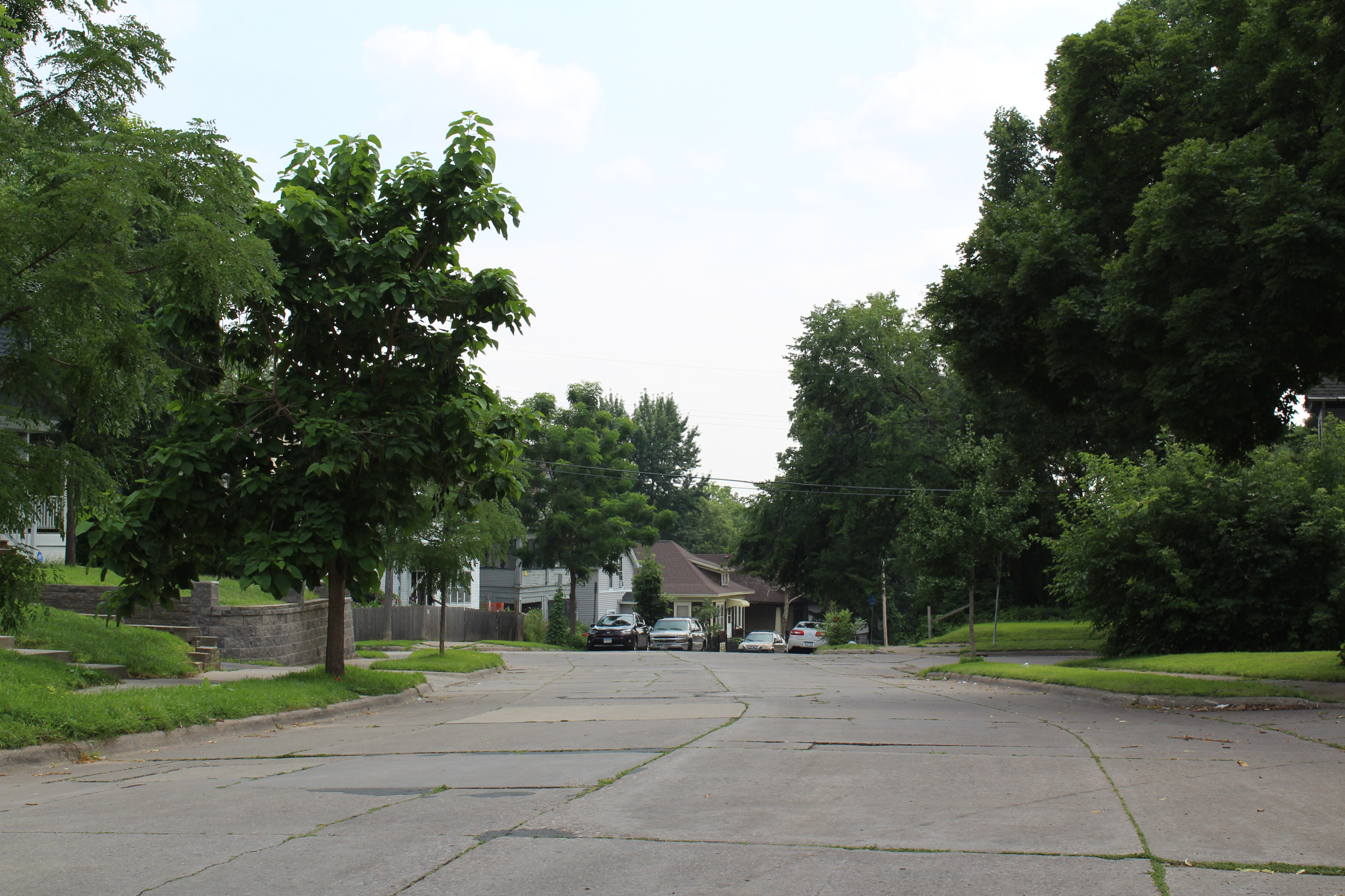
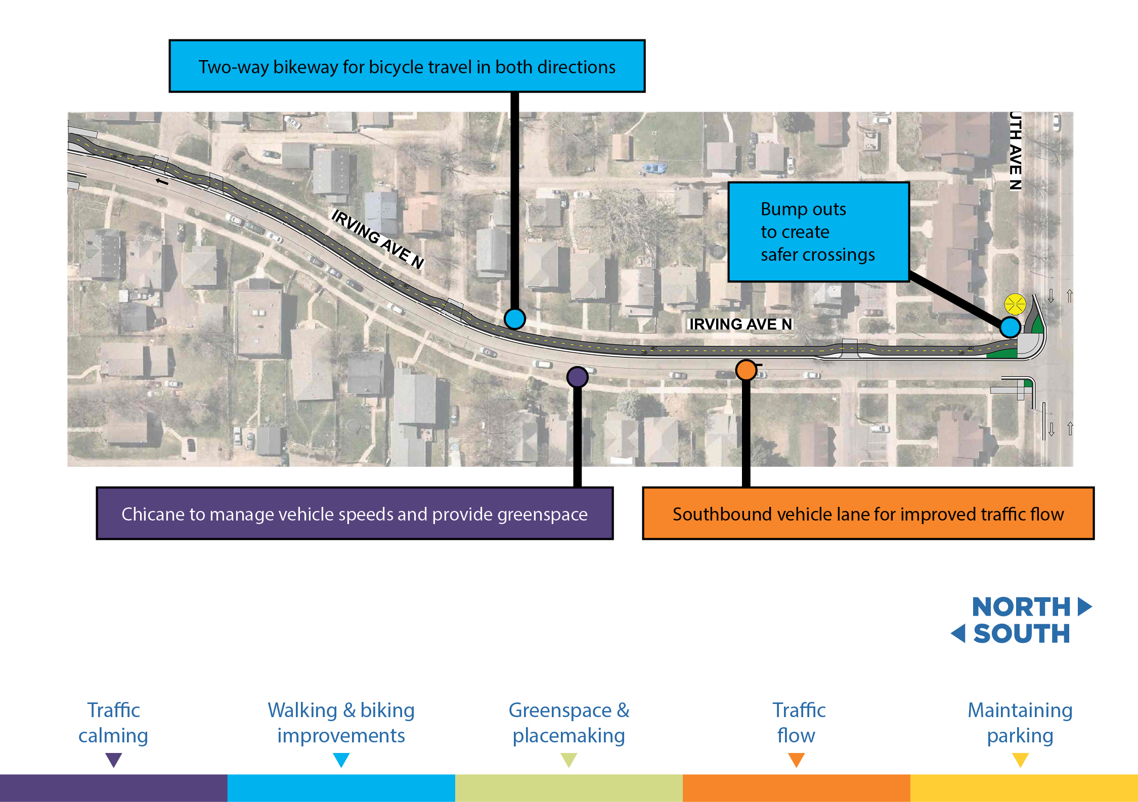
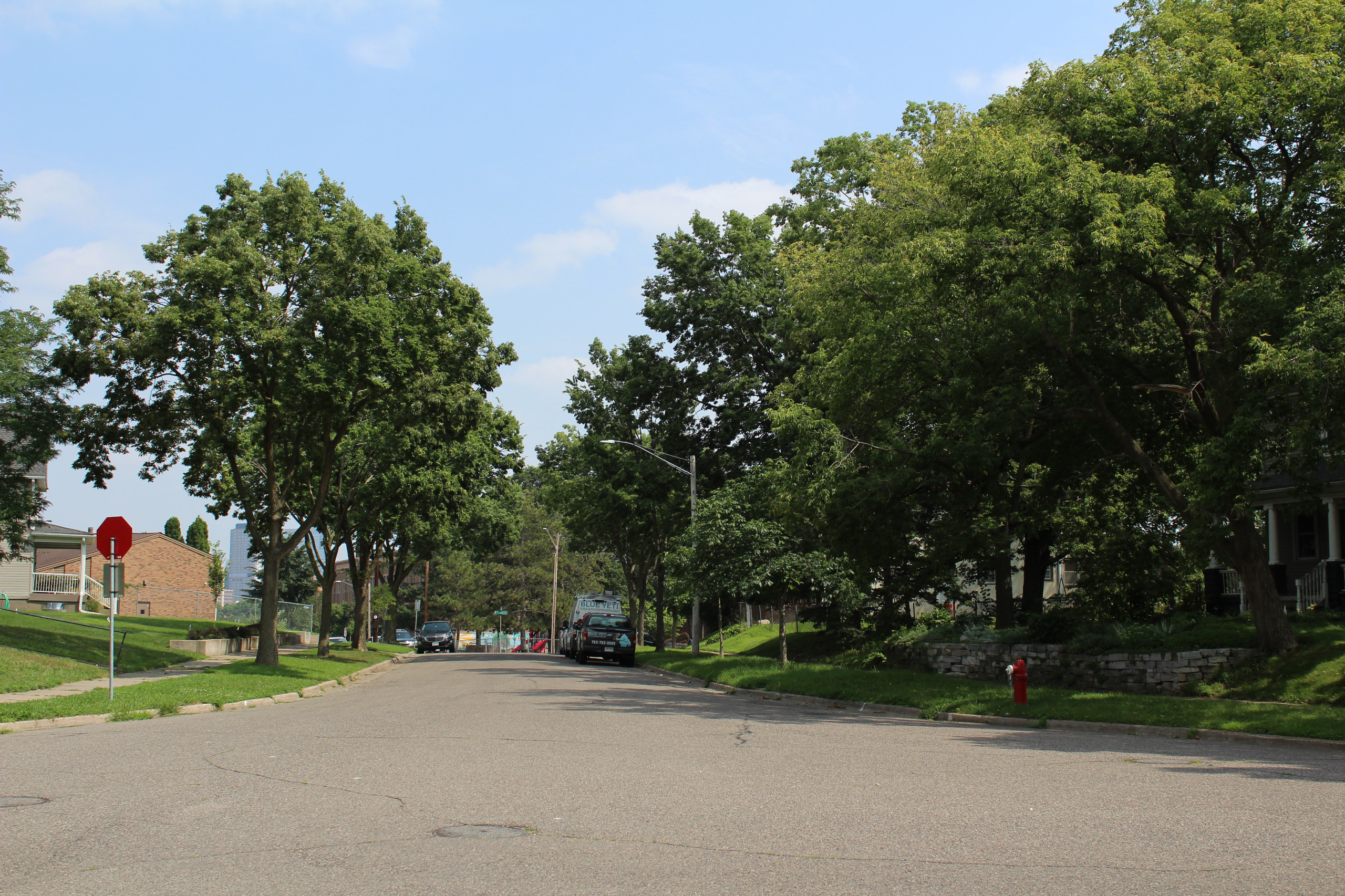
Segment A
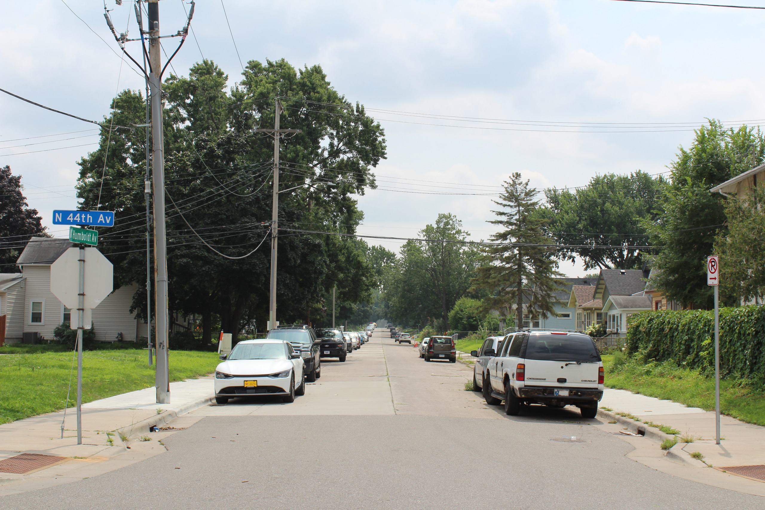
Humboldt & 44th Ave N – 41st Ave N
Image 1 of 3
Humboldt & 41st Ave N – Dowling Ave N
Image 1 of 3
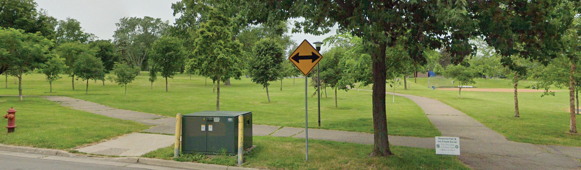
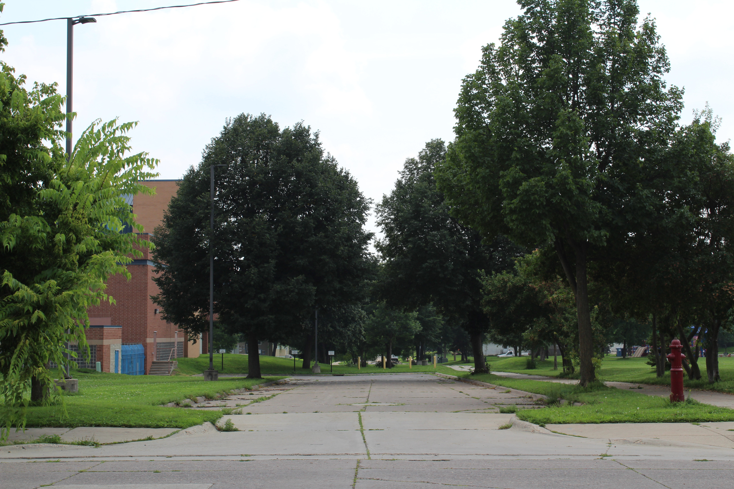
Folwell Park
Image 1 of 2
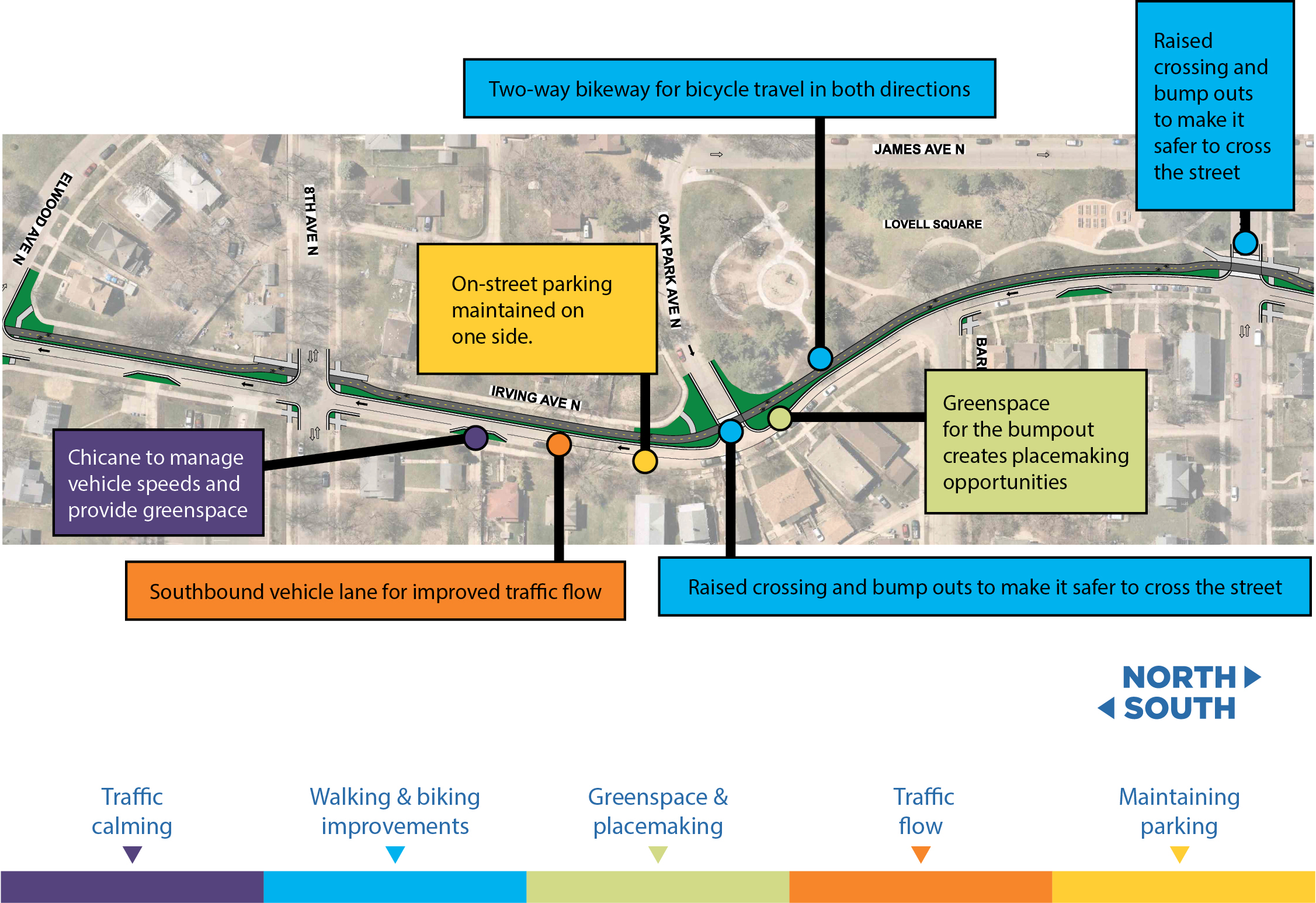
Segment B
Irving & 36 Ave N – Lowry Ave N
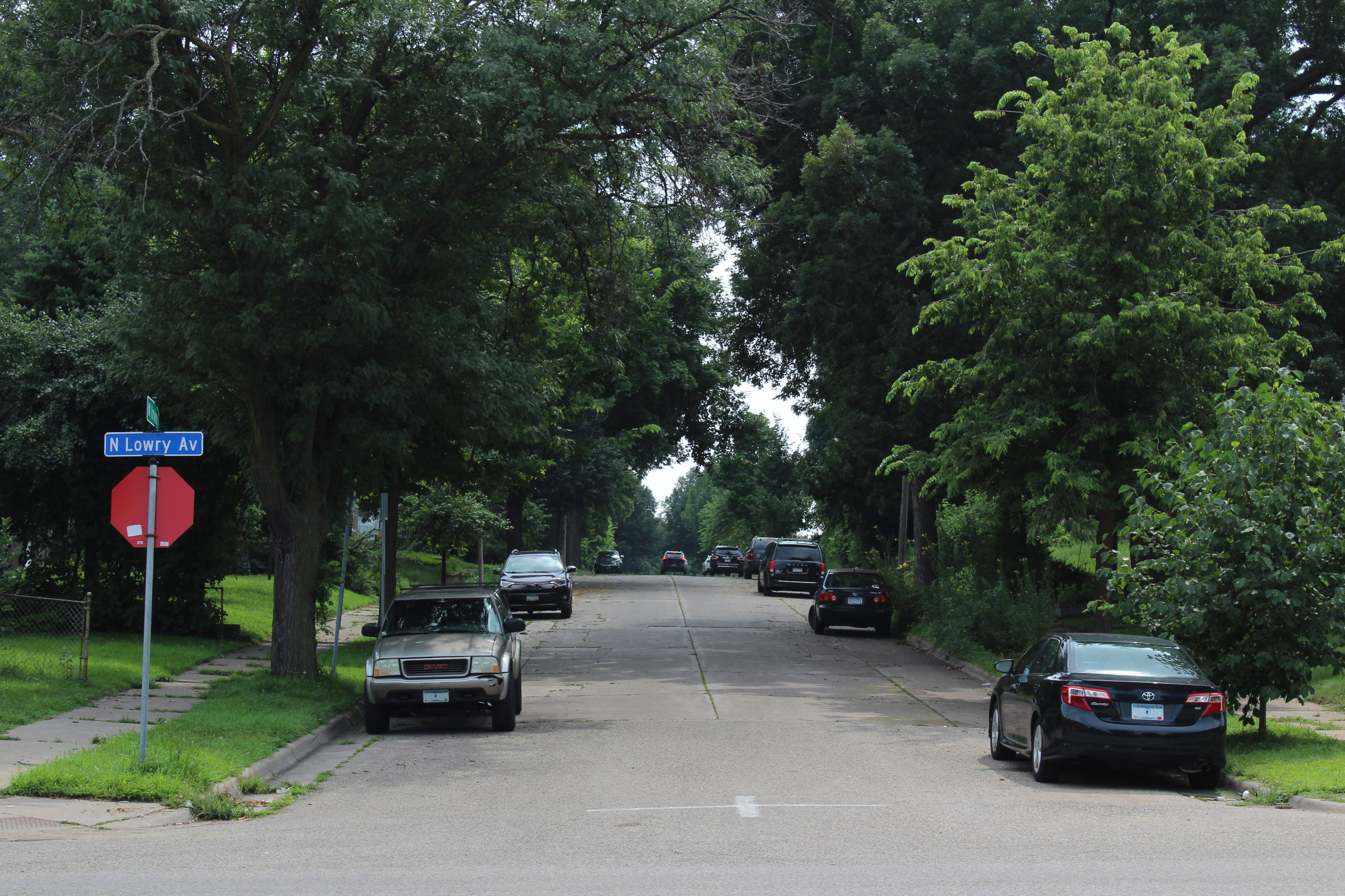
Image 1 of 3
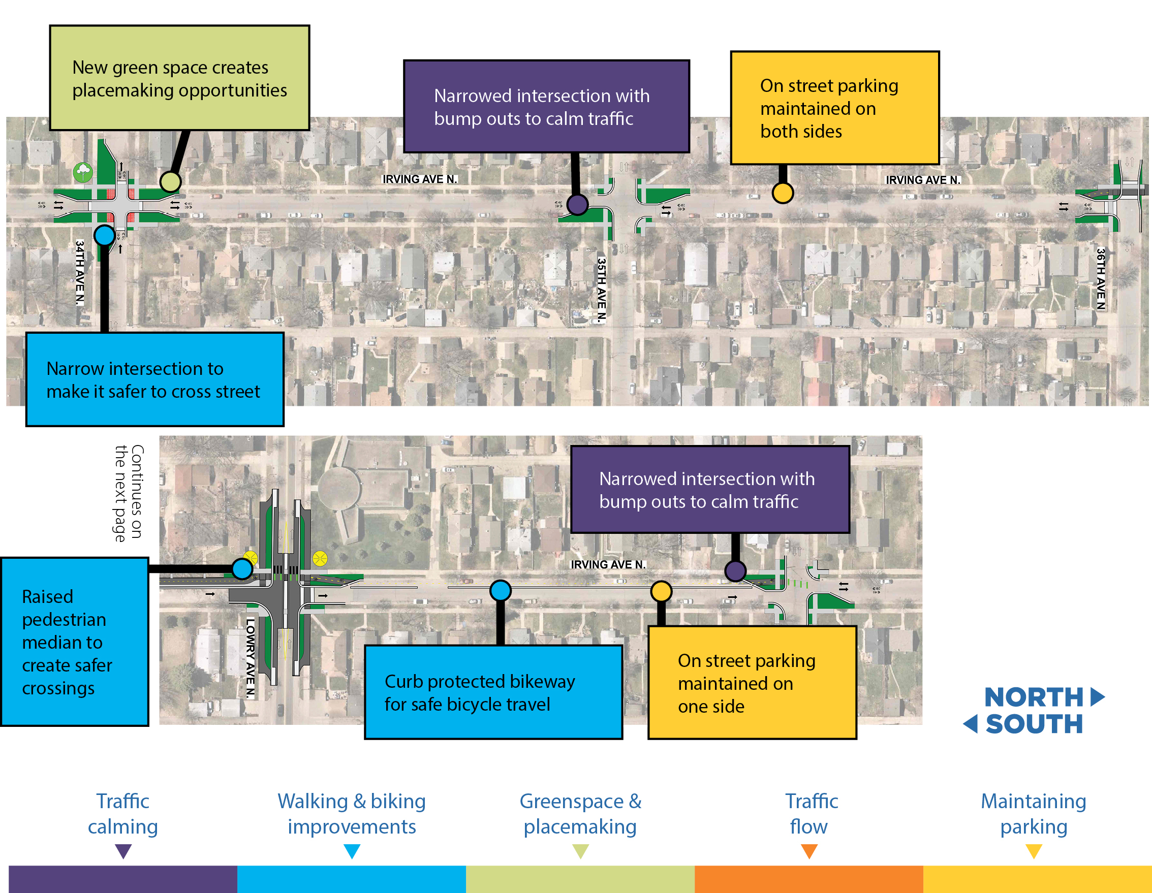
Irving & Lowry Ave N – 30th Ave North
Image 1 of 3
Jordan Park
Image 1 of 2
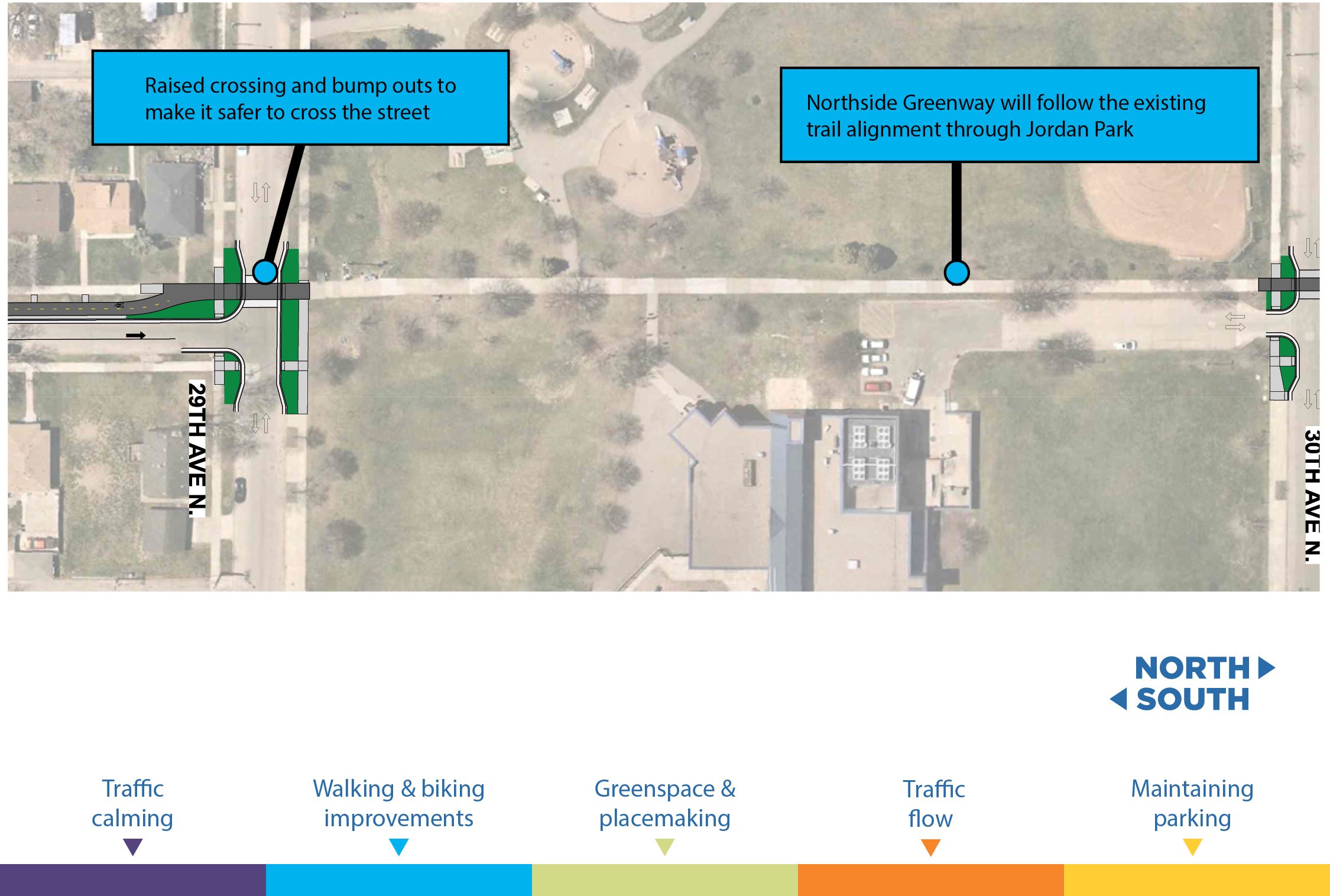
Irving & 29th Ave N – 26th Ave N
Image 1 of 3

Segment C
Irving & 26th Ave N – 23rd Ave N
Image 1 of 3
Irving & 23rd Ave N – 21st Ave
Image 1 of 3
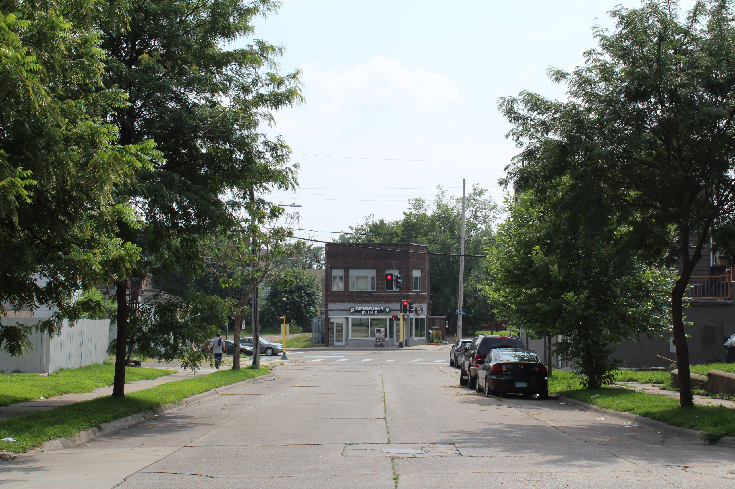
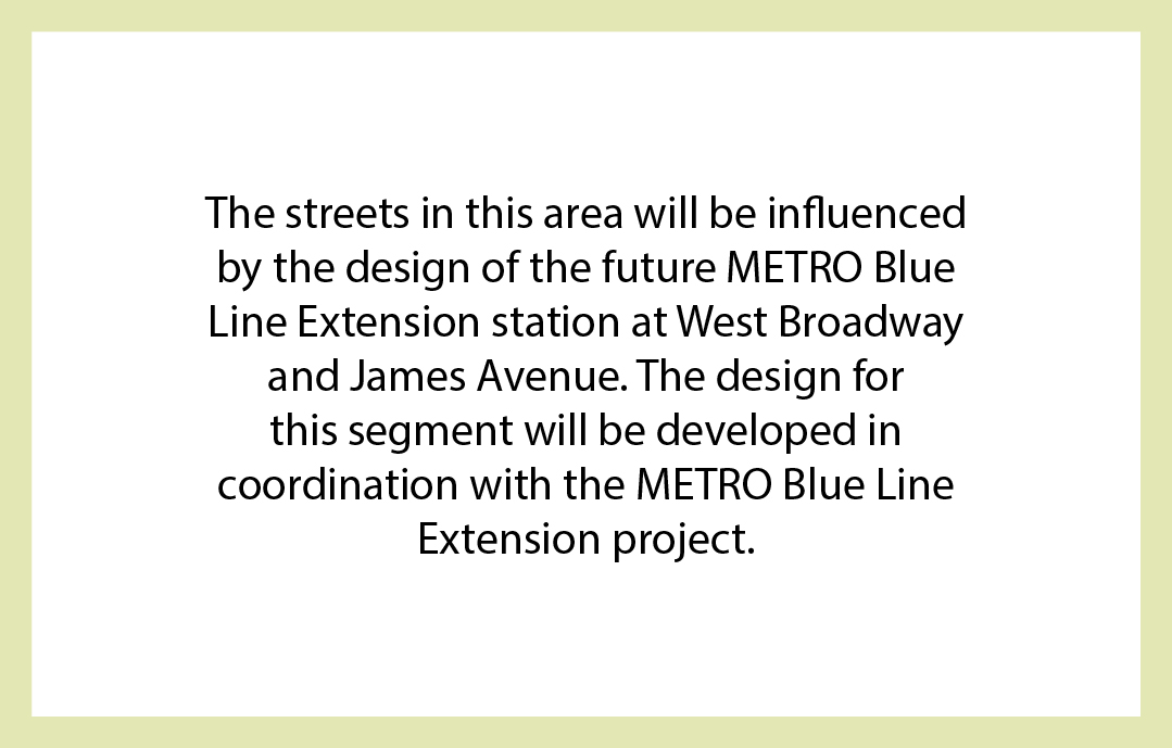
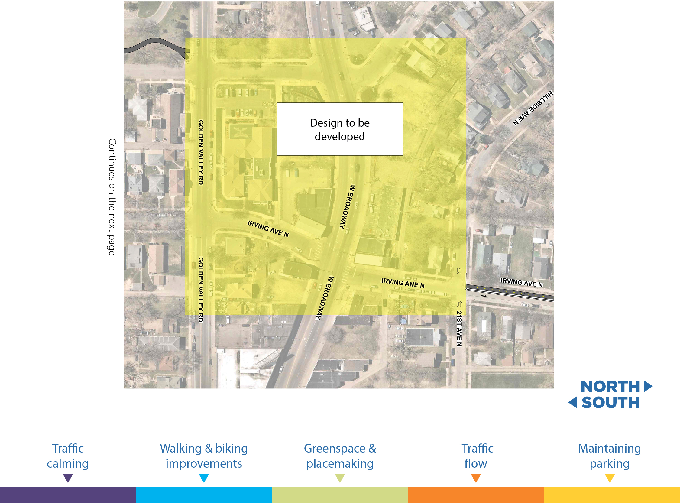
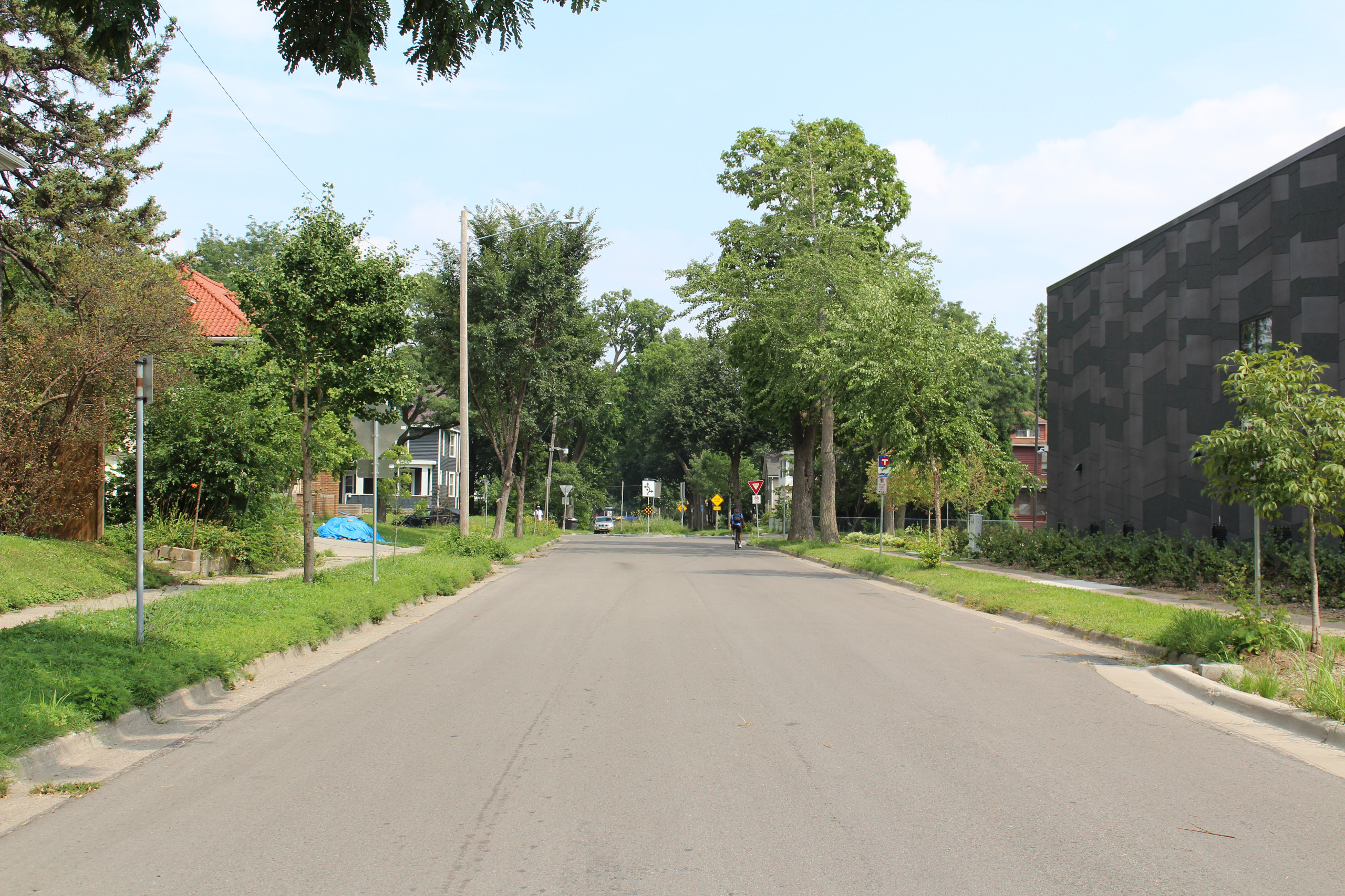
Irving & 21st Ave N – James Ave N and Golden Valley Rd
Image 1 of 3
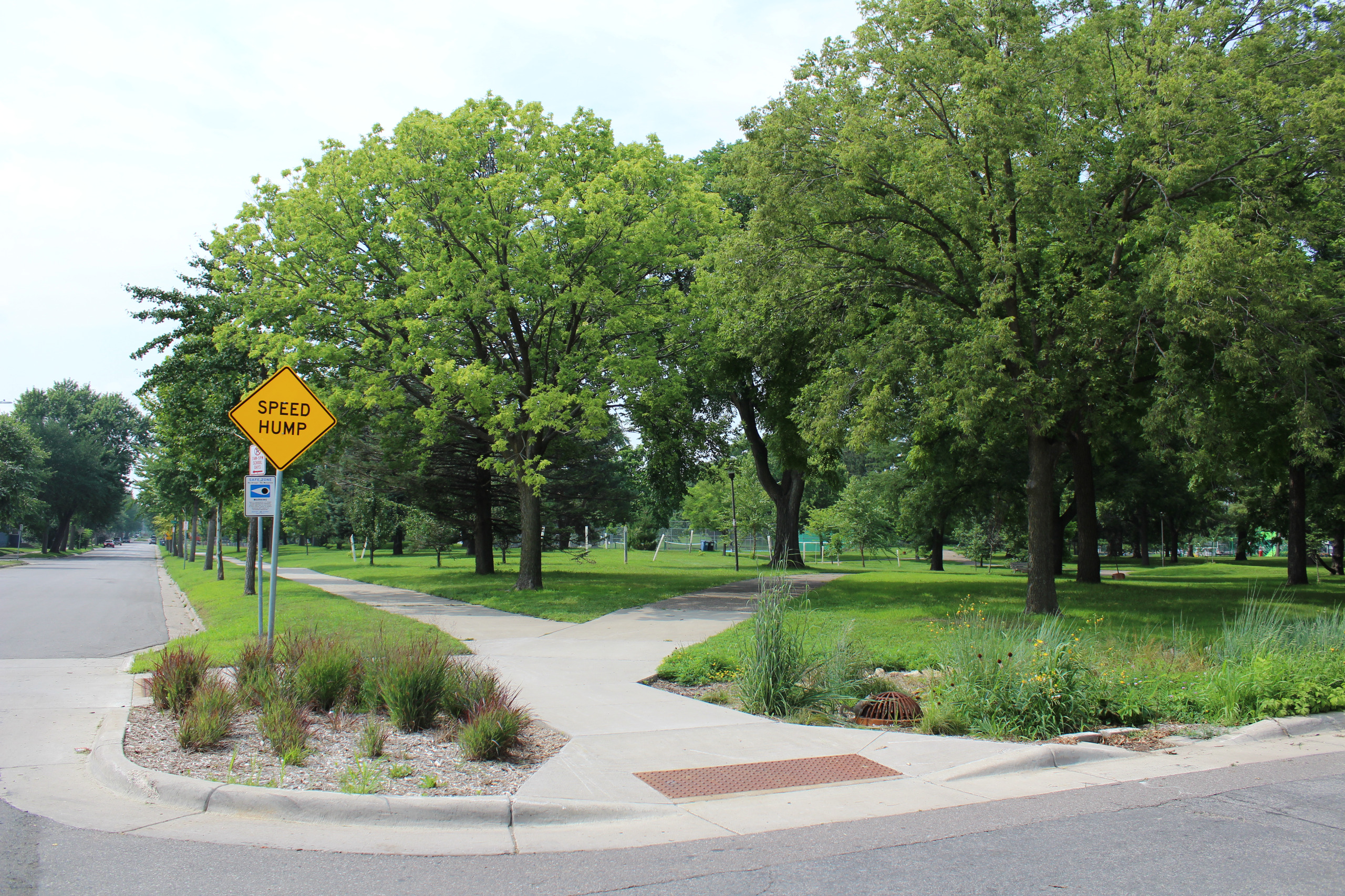
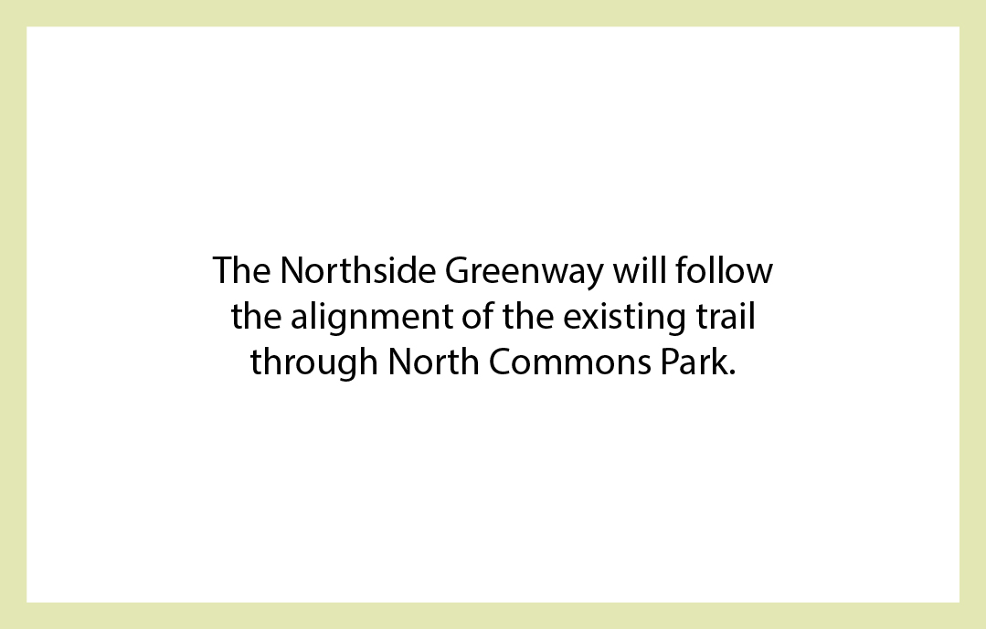
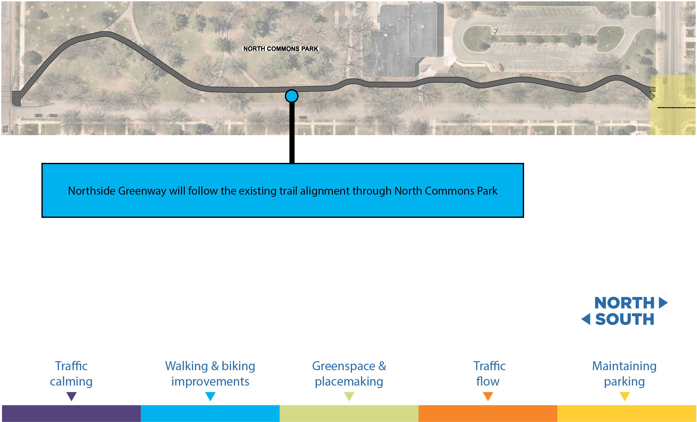
North Commons Park
Image 1 of 3
16th Ave, James Ave N - Irving Ave N
Image 1 of 3
Irving & 16th Ave N – Plymouth Ave N
Image 1 of 3

Segment D
Irving & Plymouth Ave N – 11th Ave N
Image 1 of 3


Irving & 11th Ave N – Elwood Ave N
Image 1 of 3
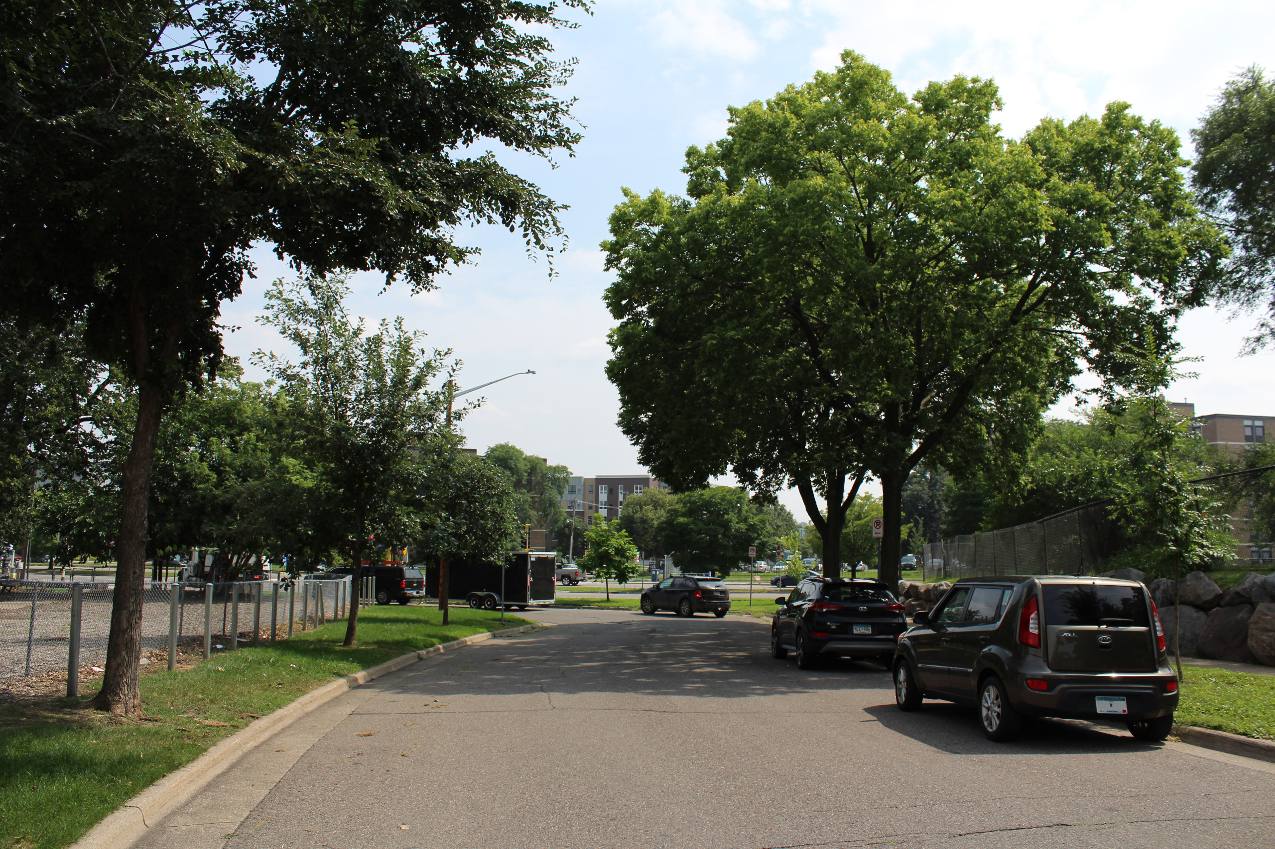
Irving & Elwood Ave N – Highway 55 South Frontage Road & Humboldt Ave N
Image 1 of 3
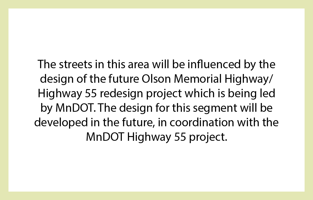
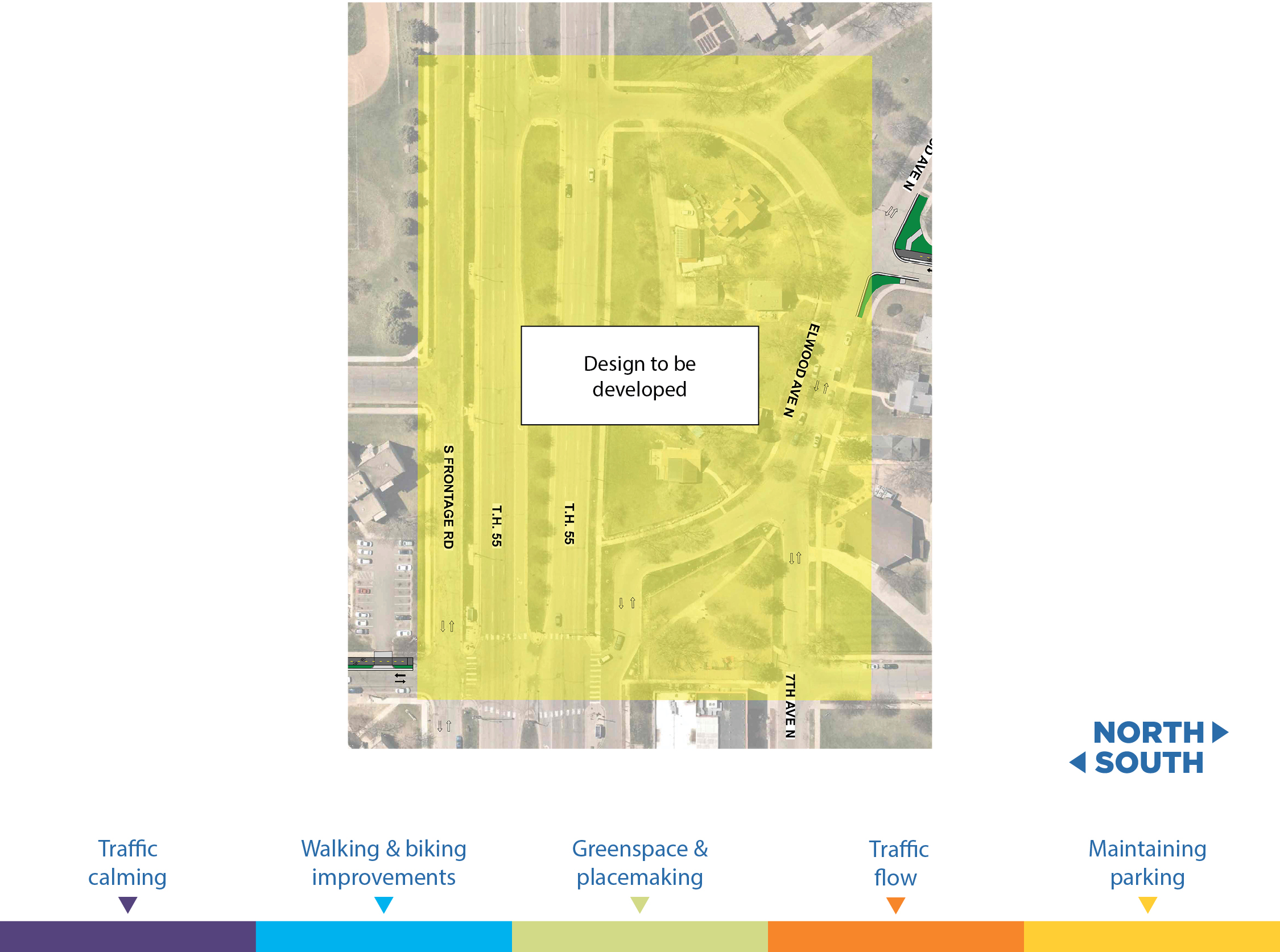
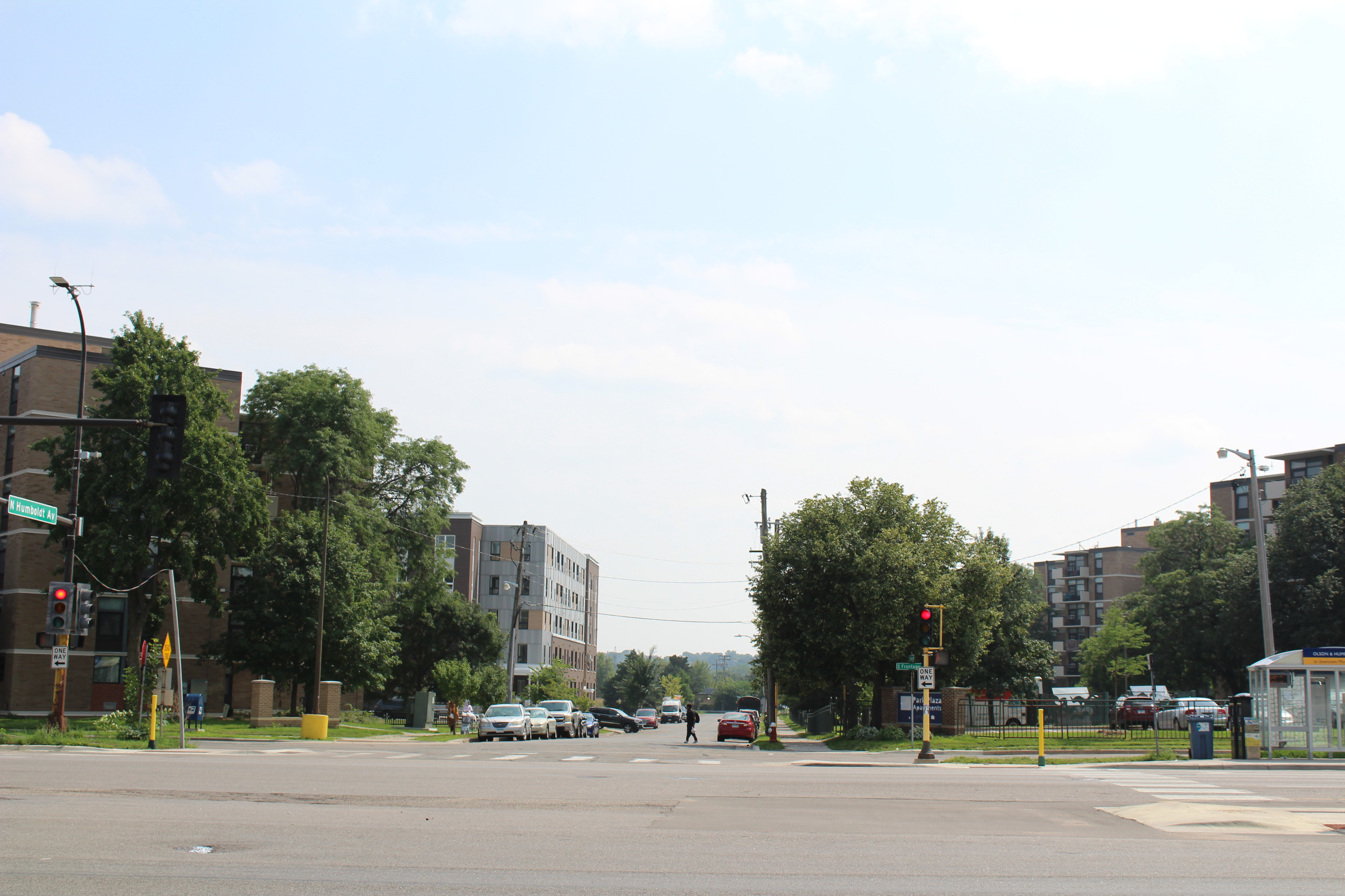
Humboldt & Olson Memorial Hwy/Trunk Hwy 55 – Van White Memorial Blvd
Image 1 of 3
Community placemaking
Community placemaking: There are several types of community placemaking under consideration, including the following.
Image 1 of 4


Contact us
Peter Bennett, Transportation Planner - Public Works | 612-673-2460 | peter.bennett@minneapolismn.gov
Allison Bell, PE, Professional Engineer - Public Works | 612-673-2453 | allison.bell@minneapolismn.gov
For reasonable accommodations or alternative formats please contact (Peter Bennett, Public Works, 612-673-2460, peter.bennett@minneapolismn.gov).
People who are deaf or hard of hearing can use a relay service to call 311 at 612-673-3000. TTY users call 612-263-6850.
Para ayuda, llame al 311. Rau kev pab, hu 311. Hadii aad caawimaad u baahantahay, wac 311.


