Draft Safety Action Plan
Appendices
Appendix A - MIC Policy Board Commitment
Appendix C - Community and Stakeholder Engagement Plan
Appendix D - Engagement Summary
Appendix E - Project and Strategy Selection
Comment Map
Prioritized Locations
Locations were tiered based on the total number of risk factors present
- Tier 1: Highest risk locations (approximately the top 5 percent).
- Tier 2: Next highest risk locations (approximately the next 5 percent).
This process resulted in a focused set of priority roadway segments and intersections where safety improvements are most likely to reduce fatal and serious injury crashes.
Once roadway segments and intersections were prioritized according to safety analysis data, they were further calibrated to reflect community priorities. For any given location, the presence of one or more community-based prioritization criteria influenced the project implementation timeframe (i.e., short-term, mid-term, long-term).
Use the maps below to review Tier 1 and 2 locations and explore which were influenced by community input.
Project Overview
The Metropolitan Interstate Council (MIC), the federally-designated transportation planning organization for the greater Duluth-Superior area, is creating a Safety Action Plan to reduce—and eventually eliminate—serious injuries and deaths from traffic crashes in our region.
This plan will focus on improving safety for everyone who uses our roads—whether you drive, walk, roll, bike, or take the bus.
The Safety Action Plan is being developed using an approach that focuses on:
- Building a strong safety culture across the region,
- Working together with elected officials, local jurisdictions, transportation agencies, safety advocates, and community members, and
- Designing safer roads that account for human mistakes and help reduce the severity of crashes.
The Duluth-Superior Safety Action Plan will identify high-risk locations and high-priority traffic safety improvements throughout the greater Duluth-Superior area. The Safety Action Plan will include clear guidance on what to do—and where—to make travel safer for everyone. It will help local governments prioritize, apply for, and justify funding for high-priority safety improvement projects. That means real safety improvements, in the places that need them most.
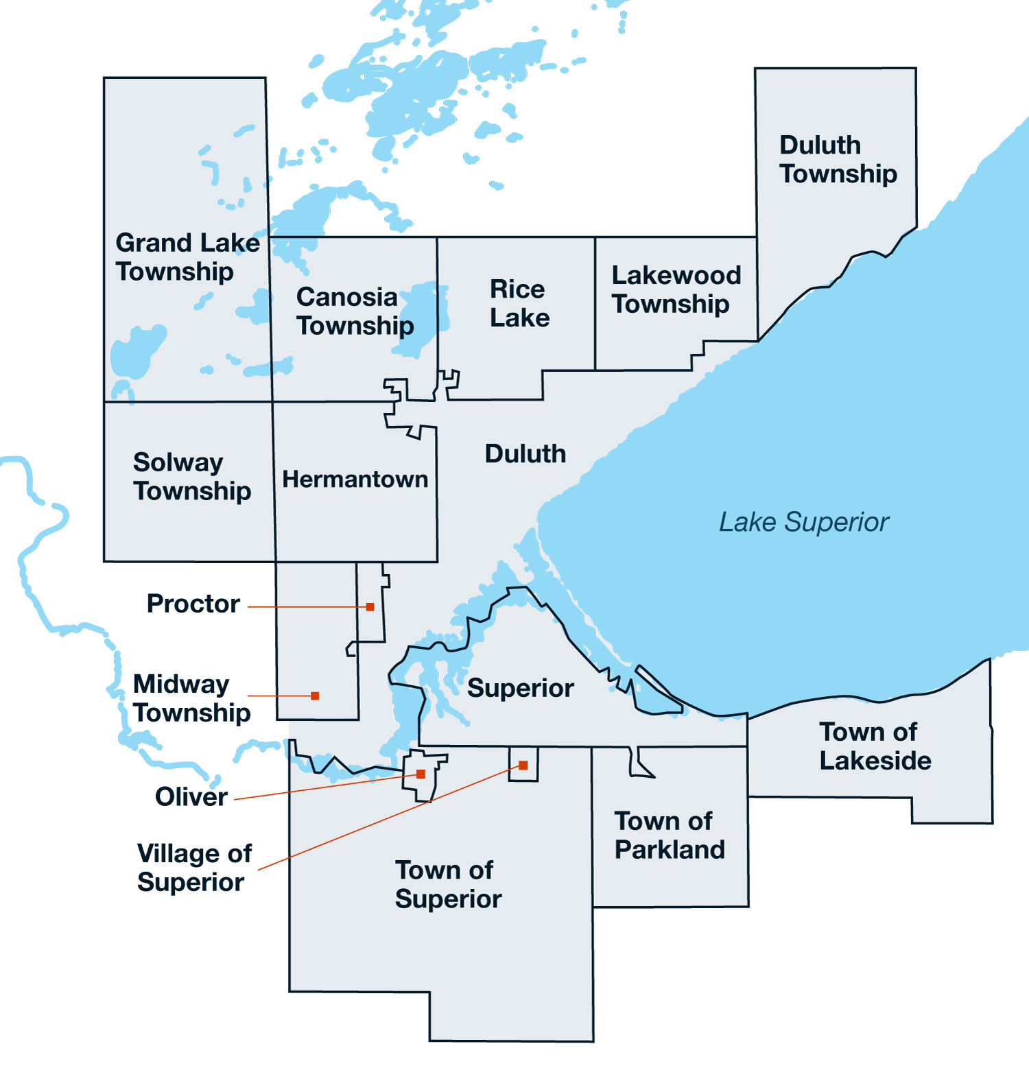
The Safety Action Plan Area covers approximately 641 square miles within St. Louis and Douglas counties in Minnesota and Wisconsin, respectively.
Project Goals:
- Listen to the community and elevate all voices to help shape the plan and ensure it reflects the real needs of people across the region.
- Build strong support among local leaders to reach a shared commitment to traffic safety.
- Recommend projects and policies that can be put into action and support coordination among jurisdictions by aligning with the U.S. DOT’s Safe System Approach.
- Establish metrics to track long-term safety outcomes and assess progress toward achieving zero roadway fatalities and serious injuries.
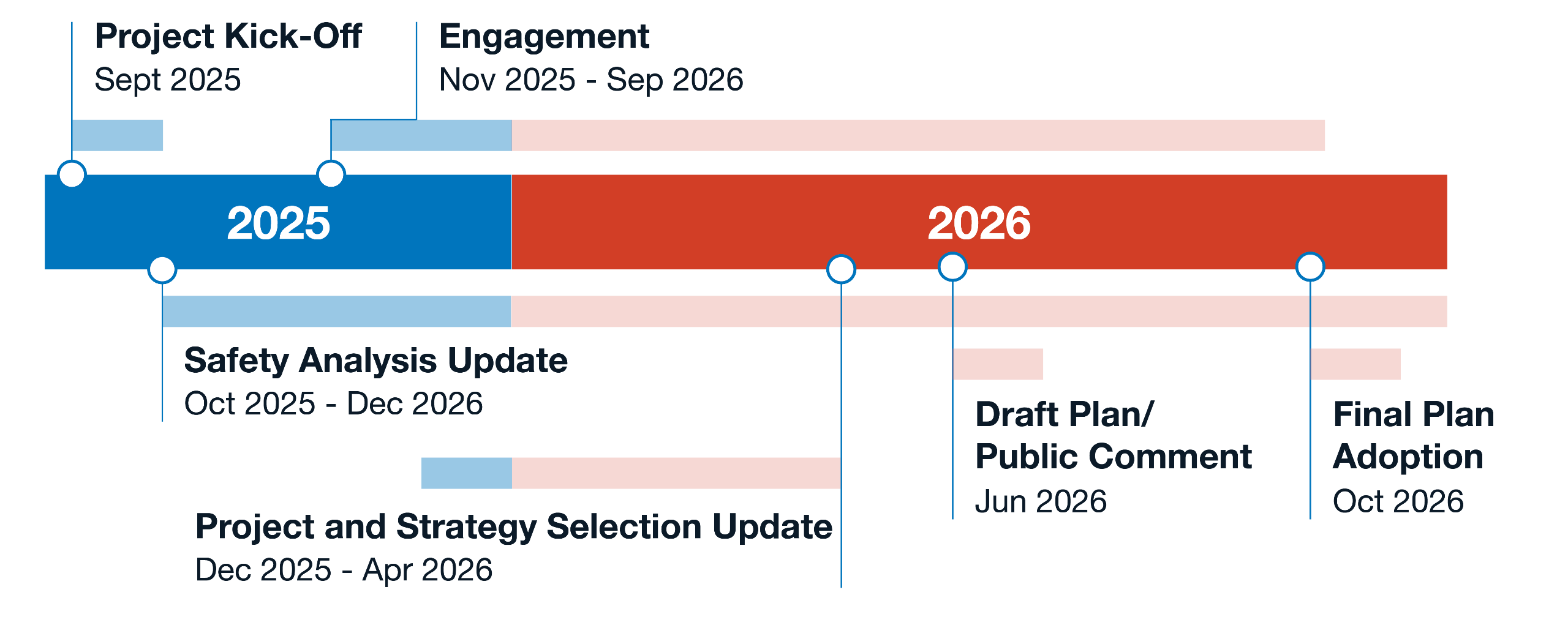
Timeline
Events
The project team will host and attend events throughout the project. Stay tuned here for updates on upcoming events.


